Area Overview for SO18 4SU
Photos of SO18 4SU
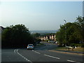
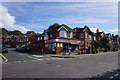
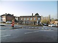
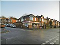


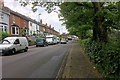


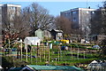
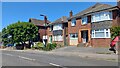
21 photos from this area
Area Information
Key information about the SO18 4SU including its size, population, and administrative classification.
- Area Type
- Postcode
- Area Size
- 4083 m²
- Population
- 1737
- Population Density
- 425377 people/km²
House Prices in SO18 4SU
16
Properties
£93,288
Average Sold Price
£28,000
Lowest Price
£146,000
Highest Price
Showing 16 properties
| Address | Type | Beds | Baths | Last Sale Price | Last Sale Date | |
|---|---|---|---|---|---|---|
| 14 Vale Drive, Southampton, SO18 4SU | Maisonette | 2 | 1 | £146,000 | Mar 2024 | |
| 22 Vale Drive, Southampton, SO18 4SU | Flat | 2 | 1 | £135,000 | Jan 2024 | |
| 24 Vale Drive, Southampton, SO18 4SU | Flat | 2 | 1 | £135,000 | Aug 2019 | |
| 26 Vale Drive, Southampton, SO18 4SU | Maisonette | 2 | 1 | £137,000 | May 2017 | |
| 8 Vale Drive, Southampton, SO18 4SU | Flat | - | - | £135,000 | Jul 2016 | |
| 2 Vale Drive, Southampton, SO18 4SU | Flat | 2 | - | £118,000 | Dec 2013 | |
| 4 Vale Drive, Southampton, SO18 4SU | Flat | - | - | £118,000 | Dec 2013 | |
| 32 Vale Drive, Southampton, SO18 4SU | Flat | 3 | 1 | £95,000 | Sep 2002 | |
| 28 Vale Drive, Southampton, SO18 4SU | Maisonette | 2 | 1 | £50,000 | Dec 2001 | |
| 12 Vale Drive, Southampton, SO18 4SU | Flat | 2 | 1 | £51,500 | May 2000 |
Page 1 of 2
Energy Efficiency in SO18 4SU
Amenities
Schools
| Rank | School | Type | Entry gender | Ages |
|---|
Explore more schools in this area
Go to Schools tabDemographics
Household Size
Family (3-5 people)
most common
Accommodation Type
Flats
most common
Tenure
35
majority
Ethnic Group
White
most common
Religion
N/A
most common
Household Composition
N/A
most common
Age
47
median
Adults (30-64 years)
most common
Household Deprivation
N/A
with no deprivation
NS-SEC
22
in Lower managerial occupations
Explore more demographic insights in this area
Go to Demographics tabPlanning
Planning Constraints
- Flood RiskPremium
- Ramsar Wetland SitesPremium
- Area of Outstanding Natural BeautyPremium
- Protected Nature ReservePremium
- Protected WoodlandPremium