Area Overview for SO18 4FG
Photos of SO18 4FG
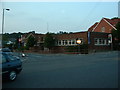
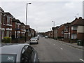

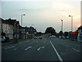
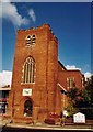


43 photos from this area
Area Information
Key information about the SO18 4FG including its size, population, and administrative classification.
- Area Type
- Postcode
- Area Size
- 1.0 hectares
- Population
- 1671
- Population Density
- 4996 people/km²
House Prices in SO18 4FG
36
Properties
£189,163
Average Sold Price
£49,000
Lowest Price
£355,000
Highest Price
Showing 36 properties
| Address | Type | Beds | Baths | Last Sale Price | Last Sale Date | |
|---|---|---|---|---|---|---|
| 36 High View Way, Southampton, SO18 4FG | Semi-detached | 2 | 1 | £275,000 | Jan 2025 | |
| 4 High View Way, Southampton, SO18 4FG | Semi-detached | 3 | 1 | £330,000 | Oct 2024 | |
| 14 High View Way, Southampton, SO18 4FG | Semi-detached | 3 | 1 | £355,000 | Jun 2024 | |
| 66 High View Way, Southampton, SO18 4FG | Semi-detached | 4 | 1 | £300,000 | May 2023 | |
| 52 High View Way, Southampton, SO18 4FG | Terraced | 3 | - | £267,000 | Jan 2023 | |
| 68 High View Way, Southampton, SO18 4FG | Semi-detached | 2 | 1 | £225,000 | May 2021 | |
| 20 High View Way, Southampton, SO18 4FG | Semi-detached | 3 | - | £280,000 | Feb 2021 | |
| 72 High View Way, Southampton, SO18 4FG | Semi-detached | 2 | 1 | £190,000 | Jul 2020 | |
| 44 High View Way, Southampton, SO18 4FG | Semi-detached | 2 | 1 | £180,000 | Oct 2018 | |
| 50 High View Way, Southampton, SO18 4FG | Terraced | 3 | 1 | £235,000 | Oct 2018 |
Page 1 of 4
Energy Efficiency in SO18 4FG
Amenities
Schools
| Rank | School | Type | Entry gender | Ages |
|---|
Explore more schools in this area
Go to Schools tabDemographics
Household Size
Family (3-5 people)
most common
Accommodation Type
Houses
most common
Tenure
73
majority
Ethnic Group
White
most common
Religion
N/A
most common
Household Composition
N/A
most common
Age
47
median
Adults (30-64 years)
most common
Household Deprivation
N/A
with no deprivation
NS-SEC
28
in Lower managerial occupations
Explore more demographic insights in this area
Go to Demographics tabPlanning
Planning Constraints
- Flood RiskPremium
- Ramsar Wetland SitesPremium
- Area of Outstanding Natural BeautyPremium
- Protected Nature ReservePremium
- Protected WoodlandPremium