Area Overview for SO18 1NJ
Photos of SO18 1NJ
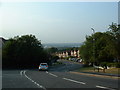
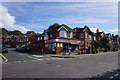
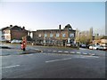
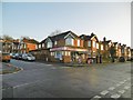

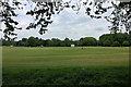
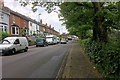
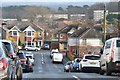
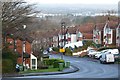
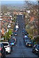
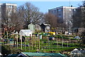
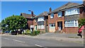
21 photos from this area
Area Information
Key information about the SO18 1NJ including its size, population, and administrative classification.
- Area Type
- Postcode
- Area Size
- 1.4 hectares
- Population
- 1504
- Population Density
- 7269 people/km²
House Prices in SO18 1NJ
48
Properties
£227,263
Average Sold Price
£57,000
Lowest Price
£500,000
Highest Price
Showing 48 properties
| Address | Type | Beds | Baths | Last Sale Price | Last Sale Date | |
|---|---|---|---|---|---|---|
| 93 Newton Road, Southampton, SO18 1NJ | Detached | 3 | 2 | £299,000 | Aug 2025 | |
| 33 Newton Road, Southampton, SO18 1NJ | Detached | 3 | 1 | £385,000 | Jan 2025 | |
| 79 Newton Road, Southampton, SO18 1NJ | Detached | 4 | 2 | £500,000 | Oct 2024 | |
| 55 Newton Road, Southampton, SO18 1NJ | Semi-detached | 3 | 1 | £278,000 | Sep 2023 | |
| 57 Newton Road, Southampton, SO18 1NJ | Bungalow | 3 | 1 | £310,000 | May 2023 | |
| 99 Newton Road, Southampton, SO18 1NJ | house | 3 | - | £308,000 | Jun 2021 | |
| 49 Newton Road, Southampton, SO18 1NJ | house | - | - | £292,000 | Jun 2021 | |
| 15 Newton Road, Southampton, SO18 1NJ | Semi-detached | 3 | 2 | £310,000 | Jun 2021 | |
| 23 Newton Road, Southampton, SO18 1NJ | Detached | 3 | - | £316,500 | Mar 2021 | |
| 71 Newton Road, Southampton, SO18 1NJ | Semi-detached | 3 | 1 | £278,500 | Feb 2020 |
Page 1 of 5
Energy Efficiency in SO18 1NJ
Amenities
Schools
| Rank | School | Type | Entry gender | Ages |
|---|
Explore more schools in this area
Go to Schools tabDemographics
Household Size
Family (3-5 people)
most common
Accommodation Type
Houses
most common
Tenure
79
majority
Ethnic Group
White
most common
Religion
N/A
most common
Household Composition
N/A
most common
Age
47
median
Adults (30-64 years)
most common
Household Deprivation
N/A
with no deprivation
NS-SEC
45
in Lower managerial occupations
Explore more demographic insights in this area
Go to Demographics tabPlanning
Planning Constraints
- Flood RiskPremium
- Ramsar Wetland SitesPremium
- Area of Outstanding Natural BeautyPremium
- Protected Nature ReservePremium
- Protected WoodlandPremium