Area Overview for SO18 1LU
Photos of SO18 1LU
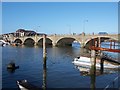

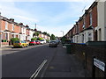
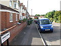
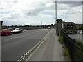


100 photos from this area
Area Information
Key information about the SO18 1LU including its size, population, and administrative classification.
- Area Type
- Postcode
- Area Size
- 1.1 hectares
- Population
- 1582
- Population Density
- 5105 people/km²
House Prices in SO18 1LU
40
Properties
£214,016
Average Sold Price
£52,000
Lowest Price
£330,000
Highest Price
Showing 40 properties
| Address | Type | Beds | Baths | Last Sale Price | Last Sale Date | |
|---|---|---|---|---|---|---|
| 86 St Catherines Road, Southampton, SO18 1LU | house | 3 | 1 | £327,000 | Mar 2025 | |
| 52 St Catherines Road, Southampton, SO18 1LU | Semi-detached | 3 | 1 | £330,000 | Jan 2024 | |
| 90 St Catherines Road, Southampton, SO18 1LU | Semi-detached | 3 | 1 | £325,000 | Oct 2022 | |
| 56 St Catherines Road, Southampton, SO18 1LU | Semi-detached | 2 | 1 | £270,000 | May 2022 | |
| 106 St Catherines Road, Southampton, SO18 1LU | Detached | 3 | 1 | £302,000 | Dec 2020 | |
| 60 St Catherines Road, Southampton, SO18 1LU | Semi-detached | 3 | 1 | £277,500 | Mar 2020 | |
| 94 St Catherines Road, Southampton, SO18 1LU | Semi-detached | 3 | 1 | £315,000 | Mar 2020 | |
| 92 St Catherines Road, Southampton, SO18 1LU | Semi-detached | 3 | 2 | £200,000 | Jan 2019 | |
| 82 St Catherines Road, Southampton, SO18 1LU | Semi-detached | 3 | 1 | £235,000 | Oct 2018 | |
| 54 St Catherines Road, Southampton, SO18 1LU | Flat | - | - | £239,000 | Apr 2017 |
Page 1 of 4
Energy Efficiency in SO18 1LU
Amenities
Schools
| Rank | School | Type | Entry gender | Ages |
|---|
Explore more schools in this area
Go to Schools tabDemographics
Household Size
One person
most common
Accommodation Type
Flats
most common
Tenure
60
majority
Ethnic Group
White
most common
Religion
N/A
most common
Household Composition
N/A
most common
Age
47
median
Adults (30-64 years)
most common
Household Deprivation
N/A
with no deprivation
NS-SEC
39
in Lower managerial occupations
Explore more demographic insights in this area
Go to Demographics tabPlanning
Planning Constraints
- Flood RiskPremium
- Ramsar Wetland SitesPremium
- Area of Outstanding Natural BeautyPremium
- Protected Nature ReservePremium
- Protected WoodlandPremium