Area Overview for SO18 1LL
Photos of SO18 1LL
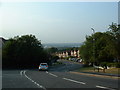
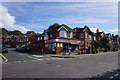
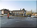
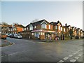

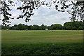
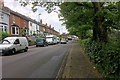
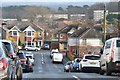
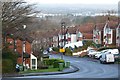
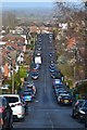
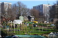
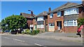
21 photos from this area
Area Information
Key information about the SO18 1LL including its size, population, and administrative classification.
- Area Type
- Postcode
- Area Size
- 4331 m²
- Population
- 1582
- Population Density
- 5105 people/km²
House Prices in SO18 1LL
19
Properties
£206,714
Average Sold Price
£81,000
Lowest Price
£430,000
Highest Price
Showing 19 properties
| Address | Type | Beds | Baths | Last Sale Price | Last Sale Date | |
|---|---|---|---|---|---|---|
| 11 St Catherines Road, Southampton, SO18 1LL | house | 4 | - | £168,000 | Dec 2020 | |
| 21 St Catherines Road, Southampton, SO18 1LL | house | - | - | £300,000 | Aug 2016 | |
| 1 St Catherines Road, Southampton, SO18 1LL | Detached | 4 | 2 | £430,000 | Jun 2016 | |
| 17 St Catherines Road, Southampton, SO18 1LL | house | - | - | £258,000 | Aug 2006 | |
| 25 St Catherines Road, Southampton, SO18 1LL | Flat | - | - | £125,000 | Mar 2000 | |
| 15 St Catherines Road, Southampton, SO18 1LL | Semi-detached | - | - | £84,995 | Dec 1997 | |
| 23 St Catherines Road, Southampton, SO18 1LL | Semi-detached | - | - | £81,000 | May 1996 | |
| First Floor Flat, 5 St Catherines Road, Southampton, SO18 1LL | Maisonette | 2 | 1 | - | - | |
| St Catherines Rest Home, 19-21 St Catherines Road, Southampton, SO18 1LL | Retirement | - | - | - | - | |
| 27A St Catherines Road, Southampton, SO18 1LL | Maisonette | 2 | - | - | - |
Page 1 of 2
Energy Efficiency in SO18 1LL
Amenities
Schools
| Rank | School | Type | Entry gender | Ages |
|---|
Explore more schools in this area
Go to Schools tabDemographics
Household Size
One person
most common
Accommodation Type
Flats
most common
Tenure
60
majority
Ethnic Group
White
most common
Religion
N/A
most common
Household Composition
N/A
most common
Age
47
median
Adults (30-64 years)
most common
Household Deprivation
N/A
with no deprivation
NS-SEC
39
in Lower managerial occupations
Explore more demographic insights in this area
Go to Demographics tabPlanning
Planning Constraints
- Flood RiskPremium
- Ramsar Wetland SitesPremium
- Area of Outstanding Natural BeautyPremium
- Protected Nature ReservePremium
- Protected WoodlandPremium