Area Overview for SO17 2FU
Photos of SO17 2FU
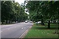
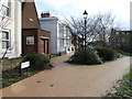
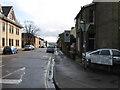

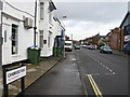
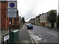
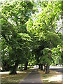
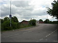
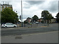
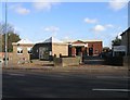

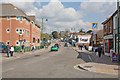
100 photos from this area
Area Information
Key information about the SO17 2FU including its size, population, and administrative classification.
- Area Type
- Postcode
- Area Size
- 4617 m²
- Population
- 1657
- Population Density
- 13253 people/km²
House Prices in SO17 2FU
20
Properties
£209,310
Average Sold Price
£129,995
Lowest Price
£342,500
Highest Price
Showing 20 properties
| Address | Type | Beds | Baths | Last Sale Price | Last Sale Date | |
|---|---|---|---|---|---|---|
| 73A Portswood Road, Southampton, SO17 2FU | Flat | 4 | 1 | £275,000 | Oct 2023 | |
| 109 Portswood Road, Southampton, SO17 2FU | Terraced | 3 | 1 | £183,000 | Apr 2021 | |
| 103 Portswood Road, Southampton, SO17 2FU | house | - | - | £140,000 | Dec 2020 | |
| 75 Portswood Road, Southampton, SO17 2FU | Flat | 2 | 1 | £342,500 | Sep 2016 | |
| 101 Portswood Road, Southampton, SO17 2FU | Terraced | 3 | 1 | £202,000 | Aug 2016 | |
| 79 Portswood Road, Southampton, SO17 2FU | Semi-detached | - | - | £310,500 | May 2016 | |
| 111 Portswood Road, Southampton, SO17 2FU | Cottage | 3 | 1 | £195,000 | Jan 2016 | |
| 107 Portswood Road, Southampton, SO17 2FU | Terraced | 3 | 1 | £129,995 | Jul 2009 | |
| 99 Portswood Road, Southampton, SO17 2FU | house | - | - | £180,100 | May 2006 | |
| 77 Portswood Road, Southampton, SO17 2FU | house | 1 | 3 | £135,000 | Aug 1999 |
Page 1 of 2
Energy Efficiency in SO17 2FU
Amenities
Schools
| Rank | School | Type | Entry gender | Ages |
|---|
Explore more schools in this area
Go to Schools tabDemographics
Household Size
One person
most common
Accommodation Type
Flats
most common
Tenure
16
majority
Ethnic Group
White
most common
Religion
N/A
most common
Household Composition
N/A
most common
Age
22
median
Young Adults (15-29 years)
most common
Household Deprivation
N/A
with no deprivation
NS-SEC
17
in Lower managerial occupations
Explore more demographic insights in this area
Go to Demographics tabPlanning
Planning Constraints
- Flood RiskPremium
- Ramsar Wetland SitesPremium
- Area of Outstanding Natural BeautyPremium
- Protected Nature ReservePremium
- Protected WoodlandPremium