Area Overview for SO16 3EQ
Photos of SO16 3EQ
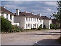

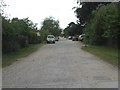
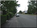
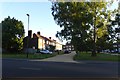
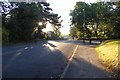

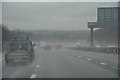
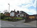
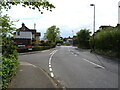
42 photos from this area
Area Information
Key information about the SO16 3EQ including its size, population, and administrative classification.
- Area Type
- Postcode
- Area Size
- 1.7 hectares
- Population
- 1344
- Population Density
- 6316 people/km²
House Prices in SO16 3EQ
30
Properties
£159,288
Average Sold Price
£40,750
Lowest Price
£258,500
Highest Price
Showing 30 properties
| Address | Type | Beds | Baths | Last Sale Price | Last Sale Date | |
|---|---|---|---|---|---|---|
| 221 Leaside Way, Southampton, SO16 3EQ | house | 3 | 1 | £221,000 | Aug 2023 | |
| 225 Leaside Way, Southampton, SO16 3EQ | Retail | 3 | 1 | £258,500 | Nov 2022 | |
| 237 Leaside Way, Southampton, SO16 3EQ | Terraced | 3 | - | £215,000 | Aug 2022 | |
| 217 Leaside Way, Southampton, SO16 3EQ | Terraced | 3 | 2 | £167,000 | Jun 2021 | |
| 249 Leaside Way, Southampton, SO16 3EQ | Terraced | 3 | 1 | £195,000 | Mar 2021 | |
| 235 Leaside Way, Southampton, SO16 3EQ | house | - | - | £190,000 | Dec 2020 | |
| 215 Leaside Way, Southampton, SO16 3EQ | Terraced | 3 | 1 | £185,000 | Sep 2020 | |
| 227 Leaside Way, Southampton, SO16 3EQ | house | - | - | £185,275 | Jul 2019 | |
| 229 Leaside Way, Southampton, SO16 3EQ | Terraced | 3 | 1 | £181,000 | Nov 2017 | |
| 209 Leaside Way, Southampton, SO16 3EQ | Terraced | 3 | 1 | £172,000 | Aug 2017 |
Page 1 of 3
Energy Efficiency in SO16 3EQ
Amenities
Schools
| Rank | School | Type | Entry gender | Ages |
|---|
Explore more schools in this area
Go to Schools tabDemographics
Household Size
One person
most common
Accommodation Type
Houses
most common
Tenure
43
majority
Ethnic Group
White
most common
Religion
N/A
most common
Household Composition
N/A
most common
Age
47
median
Adults (30-64 years)
most common
Household Deprivation
N/A
with no deprivation
NS-SEC
23
in Lower managerial occupations
Explore more demographic insights in this area
Go to Demographics tabPlanning
Planning Constraints
- Flood RiskPremium
- Ramsar Wetland SitesPremium
- Area of Outstanding Natural BeautyPremium
- Protected Nature ReservePremium
- Protected WoodlandPremium