Area Overview for SO16 3EN
Photos of SO16 3EN
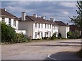
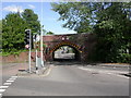
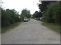
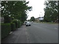
42 photos from this area
Area Information
Key information about the SO16 3EN including its size, population, and administrative classification.
- Area Type
- Postcode
- Area Size
- 1.2 hectares
- Population
- 1344
- Population Density
- 6316 people/km²
House Prices in SO16 3EN
39
Properties
£119,707
Average Sold Price
£39,000
Lowest Price
£251,000
Highest Price
Showing 39 properties
| Address | Type | Beds | Baths | Last Sale Price | Last Sale Date | |
|---|---|---|---|---|---|---|
| 44 Leaside Way, Southampton, SO16 3EN | Terraced | 3 | 1 | £195,000 | Mar 2024 | |
| 72 Leaside Way, Southampton, SO16 3EN | Retail | 3 | 1 | £251,000 | Aug 2022 | |
| 56 Leaside Way, Southampton, SO16 3EN | Terraced | 3 | 1 | £175,000 | Feb 2020 | |
| 42 Leaside Way, Southampton, SO16 3EN | Terraced | 3 | 1 | £171,000 | Jul 2019 | |
| 66 Leaside Way, Southampton, SO16 3EN | Terraced | 3 | 1 | £169,000 | May 2019 | |
| 70 Leaside Way, Southampton, SO16 3EN | Terraced | 2 | 1 | £155,000 | Feb 2015 | |
| 102 Leaside Way, Southampton, SO16 3EN | Terraced | 3 | - | £123,000 | Dec 2013 | |
| 110 Leaside Way, Southampton, SO16 3EN | house | 3 | - | £125,000 | Dec 2013 | |
| 80 Leaside Way, Southampton, SO16 3EN | house | 3 | - | £124,500 | Jul 2012 | |
| 104 Leaside Way, Southampton, SO16 3EN | house | 3 | - | £134,995 | Aug 2010 |
Page 1 of 4
Energy Efficiency in SO16 3EN
Amenities
Schools
| Rank | School | Type | Entry gender | Ages |
|---|
Explore more schools in this area
Go to Schools tabDemographics
Household Size
One person
most common
Accommodation Type
Houses
most common
Tenure
43
majority
Ethnic Group
White
most common
Religion
N/A
most common
Household Composition
N/A
most common
Age
47
median
Adults (30-64 years)
most common
Household Deprivation
N/A
with no deprivation
NS-SEC
23
in Lower managerial occupations
Explore more demographic insights in this area
Go to Demographics tabPlanning
Planning Constraints
- Flood RiskPremium
- Ramsar Wetland SitesPremium
- Area of Outstanding Natural BeautyPremium
- Protected Nature ReservePremium
- Protected WoodlandPremium