Area Overview for SM7 1NQ
Photos of SM7 1NQ
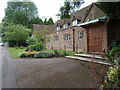
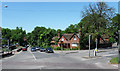
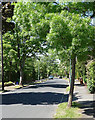
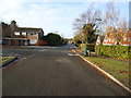
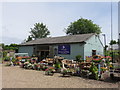
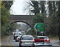
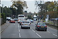
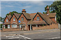
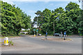
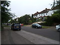
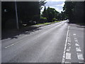
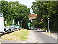
25 photos from this area
Area Information
Key information about the SM7 1NQ including its size, population, and administrative classification.
- Area Type
- Postcode
- Area Size
- 2.2 hectares
- Population
- 1512
- Population Density
- 3562 people/km²
House Prices in SM7 1NQ
32
Properties
£621,247
Average Sold Price
£150,000
Lowest Price
£1,085,000
Highest Price
Showing 32 properties
| Address | Type | Beds | Baths | Last Sale Price | Last Sale Date | |
|---|---|---|---|---|---|---|
| 54 Fir Tree Road, Banstead, SM7 1NQ | Detached | 4 | 2 | £820,000 | Nov 2023 | |
| 72 Fir Tree Road, Banstead, SM7 1NQ | house | - | - | £945,000 | Jan 2021 | |
| 74 Fir Tree Road, Banstead, SM7 1NQ | Bungalow | 3 | 1 | £730,000 | Dec 2020 | |
| 56 Fir Tree Road, Banstead, SM7 1NQ | Detached | 3 | 1 | £720,000 | Oct 2020 | |
| 96 Fir Tree Road, Banstead, SM7 1NQ | Detached | 4 | 3 | £720,000 | Nov 2019 | |
| 100 Fir Tree Road, Banstead, SM7 1NQ | Detached | 4 | 2 | £850,000 | Mar 2019 | |
| 98 Fir Tree Road, Banstead, SM7 1NQ | Detached | 4 | 2 | £885,000 | Dec 2016 | |
| 90 Fir Tree Road, Banstead, SM7 1NQ | Detached | 4 | - | £885,000 | Dec 2014 | |
| 92 Fir Tree Road, Banstead, SM7 1NQ | Detached | 5 | 3 | £1,085,000 | Nov 2014 | |
| 88 Fir Tree Road, Banstead, SM7 1NQ | Detached | 3 | 1 | £485,000 | Jun 2014 |
Page 1 of 4
Energy Efficiency in SM7 1NQ
Amenities
Schools
| Rank | School | Type | Entry gender | Ages |
|---|
Explore more schools in this area
Go to Schools tabDemographics
Household Size
Family (3-5 people)
most common
Accommodation Type
Houses
most common
Tenure
93
majority
Ethnic Group
White
most common
Religion
N/A
most common
Household Composition
N/A
most common
Age
47
median
Adults (30-64 years)
most common
Household Deprivation
N/A
with no deprivation
NS-SEC
47
in Lower managerial occupations
Explore more demographic insights in this area
Go to Demographics tabPlanning
Planning Constraints
- Flood RiskPremium
- Ramsar Wetland SitesPremium
- Area of Outstanding Natural BeautyPremium
- Protected Nature ReservePremium
- Protected WoodlandPremium