Area Overview for SM7 1LL
Photos of SM7 1LL
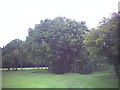
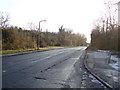
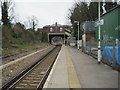
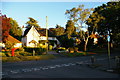
36 photos from this area
Area Information
Key information about the SM7 1LL including its size, population, and administrative classification.
- Area Type
- Postcode
- Area Size
- 5.5 hectares
- Population
- 1611
- Population Density
- 1622 people/km²
House Prices in SM7 1LL
64
Properties
£444,527
Average Sold Price
£114,000
Lowest Price
£920,000
Highest Price
Showing 64 properties
| Address | Type | Beds | Baths | Last Sale Price | Last Sale Date | |
|---|---|---|---|---|---|---|
| 8 Osier Way, Banstead, SM7 1LL | Detached | 4 | 2 | £667,000 | Oct 2025 | |
| 39 Osier Way, Banstead, SM7 1LL | Detached | 4 | 2 | £850,000 | Oct 2023 | |
| 7 Osier Way, Banstead, SM7 1LL | Detached | 3 | 1 | £563,500 | Jul 2023 | |
| 19 Osier Way, Banstead, SM7 1LL | house | - | - | £635,000 | Aug 2022 | |
| 14 Osier Way, Banstead, SM7 1LL | house | - | - | £520,000 | Mar 2022 | |
| 32 Osier Way, Banstead, SM7 1LL | Detached | 3 | - | £620,000 | Jan 2022 | |
| 52 Osier Way, Banstead, SM7 1LL | house | - | - | £580,000 | Oct 2021 | |
| 41 Osier Way, Banstead, SM7 1LL | Detached | 4 | 4 | £920,000 | Sep 2021 | |
| 74 Osier Way, Banstead, SM7 1LL | house | - | - | £690,000 | Mar 2021 | |
| 27 Osier Way, Banstead, SM7 1LL | Detached | 4 | 1 | £595,000 | Mar 2021 |
Page 1 of 7
Energy Efficiency in SM7 1LL
Amenities
Schools
| Rank | School | Type | Entry gender | Ages |
|---|
Explore more schools in this area
Go to Schools tabDemographics
Household Size
Family (3-5 people)
most common
Accommodation Type
Houses
most common
Tenure
77
majority
Ethnic Group
White
most common
Religion
N/A
most common
Household Composition
N/A
most common
Age
47
median
Adults (30-64 years)
most common
Household Deprivation
N/A
with no deprivation
NS-SEC
47
in Lower managerial occupations
Explore more demographic insights in this area
Go to Demographics tabPlanning
Planning Constraints
- Flood RiskPremium
- Ramsar Wetland SitesPremium
- Area of Outstanding Natural BeautyPremium
- Protected Nature ReservePremium
- Protected WoodlandPremium