Area Overview for SM2 7DP
Photos of SM2 7DP

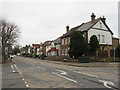
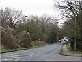
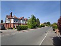
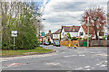
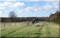
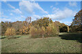
29 photos from this area
Area Information
Key information about the SM2 7DP including its size, population, and administrative classification.
- Area Type
- Postcode
- Area Size
- 24.9 hectares
- Population
- 1611
- Population Density
- 1622 people/km²
House Prices in SM2 7DP
23
Properties
£1,952,836
Average Sold Price
£676,000
Lowest Price
£3,722,000
Highest Price
Showing 23 properties
| Address | Type | Beds | Baths | Last Sale Price | Last Sale Date | |
|---|---|---|---|---|---|---|
| Moorlands, The Drive, Cheam, SM2 7DP | Detached | 5 | 3 | £3,722,000 | Dec 2022 | |
| High Burrows, The Drive, Cheam, SM2 7DP | Detached | 5 | 3 | £1,430,000 | May 2019 | |
| Whincop, The Drive, Cheam, SM2 7DP | Detached | 6 | 5 | £2,950,000 | Jan 2018 | |
| Heather Grange, The Drive, Cheam, SM2 7DP | Detached | 6 | 6 | £3,250,000 | Feb 2017 | |
| Archdale Manor, The Drive, Cheam, SM2 7DP | Detached | 6 | 6 | £3,000,000 | Dec 2016 | |
| Hobart House, The Drive, Cheam, SM2 7DP | house | 6 | - | £2,155,000 | Mar 2016 | |
| Worseley House, The Drive, Cheam, SM2 7DP | house | - | - | £2,175,000 | Apr 2011 | |
| Oakwood, The Drive, Cheam, SM2 7DP | Detached | - | - | £865,000 | Jun 2009 | |
| Rosmore, The Drive, Cheam, SM2 7DP | house | - | - | £1,270,000 | Apr 2009 | |
| Sandy Lodge, The Drive, Cheam, SM2 7DP | Detached | - | - | £1,050,000 | Aug 2008 |
Page 1 of 3
Energy Efficiency in SM2 7DP
Amenities
Schools
| Rank | School | Type | Entry gender | Ages |
|---|
Explore more schools in this area
Go to Schools tabDemographics
Household Size
Family (3-5 people)
most common
Accommodation Type
Houses
most common
Tenure
77
majority
Ethnic Group
White
most common
Religion
N/A
most common
Household Composition
N/A
most common
Age
47
median
Adults (30-64 years)
most common
Household Deprivation
N/A
with no deprivation
NS-SEC
47
in Lower managerial occupations
Explore more demographic insights in this area
Go to Demographics tabPlanning
Planning Constraints
- Flood RiskPremium
- Ramsar Wetland SitesPremium
- Area of Outstanding Natural BeautyPremium
- Protected Nature ReservePremium
- Protected WoodlandPremium