Area Overview for SL8 5TU
Photos of SL8 5TU
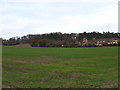
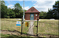
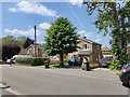

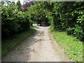
8 photos from this area
Area Information
Key information about the SL8 5TU including its size, population, and administrative classification.
- Area Type
- Postcode
- Area Size
- 9068 m²
- Population
- 1264
- Population Density
- 2671 people/km²
House Prices in SL8 5TU
19
Properties
£425,546
Average Sold Price
£157,500
Lowest Price
£745,000
Highest Price
Showing 19 properties
| Address | Type | Beds | Baths | Last Sale Price | Last Sale Date | |
|---|---|---|---|---|---|---|
| 69 Goddington Road, Bourne End, SL8 5TU | Semi-detached | 5 | 1 | £745,000 | Jul 2024 | |
| 37 Goddington Road, Bourne End, SL8 5TU | house | - | - | £655,000 | Dec 2017 | |
| 41 Goddington Road, Bourne End, SL8 5TU | house | - | - | £675,000 | Dec 2016 | |
| 55 Goddington Road, Bourne End, SL8 5TU | Semi-detached | 3 | - | £495,000 | Jun 2016 | |
| 59 Goddington Road, Bourne End, SL8 5TU | house | - | - | £404,050 | May 2015 | |
| 51 Goddington Road, Bourne End, SL8 5TU | house | 3 | - | £329,000 | Jul 2012 | |
| 49 Goddington Road, Bourne End, SL8 5TU | house | 4 | - | £510,000 | Oct 2010 | |
| 35 Goddington Road, Bourne End, SL8 5TU | Detached | 4 | 2 | £370,000 | Jan 2003 | |
| 61 Goddington Road, Bourne End, SL8 5TU | Semi-detached | - | - | £250,000 | Oct 2002 | |
| 33 Goddington Road, Bourne End, SL8 5TU | Detached | - | - | £286,000 | Jun 2000 |
Page 1 of 2
Energy Efficiency in SL8 5TU
Amenities
Schools
| Rank | School | Type | Entry gender | Ages |
|---|
Explore more schools in this area
Go to Schools tabDemographics
Household Size
Family (3-5 people)
most common
Accommodation Type
Houses
most common
Tenure
88
majority
Ethnic Group
White
most common
Religion
N/A
most common
Household Composition
N/A
most common
Age
47
median
Adults (30-64 years)
most common
Household Deprivation
N/A
with no deprivation
NS-SEC
50
in Lower managerial occupations
Explore more demographic insights in this area
Go to Demographics tabPlanning
Planning Constraints
- Flood RiskPremium
- Ramsar Wetland SitesPremium
- Area of Outstanding Natural BeautyPremium
- Protected Nature ReservePremium
- Protected WoodlandPremium