Area Overview for SL8 5TH
Photos of SL8 5TH
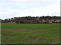
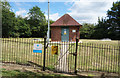
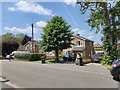

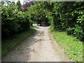
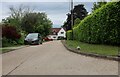
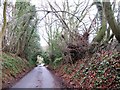
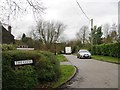
8 photos from this area
Area Information
Key information about the SL8 5TH including its size, population, and administrative classification.
- Area Type
- Postcode
- Area Size
- 1.7 hectares
- Population
- 1264
- Population Density
- 2671 people/km²
House Prices in SL8 5TH
30
Properties
£460,605
Average Sold Price
£155,000
Lowest Price
£900,000
Highest Price
Showing 30 properties
| Address | Type | Beds | Baths | Last Sale Price | Last Sale Date | |
|---|---|---|---|---|---|---|
| 79 Chalklands, Bourne End, SL8 5TH | house | 3 | 1 | £655,000 | Jun 2025 | |
| 39 Chalklands, Bourne End, SL8 5TH | Semi-detached | 5 | 2 | £723,000 | Mar 2025 | |
| 51 Chalklands, Bourne End, SL8 5TH | Semi-detached | 3 | 2 | £552,500 | Mar 2021 | |
| 69 Chalklands, Bourne End, SL8 5TH | Bungalow | 2 | 1 | £900,000 | Oct 2020 | |
| 43 Chalklands, Bourne End, SL8 5TH | Semi-detached | 3 | 1 | £480,000 | Sep 2019 | |
| 25 Chalklands, Bourne End, SL8 5TH | Semi-detached | 4 | 2 | £645,000 | Sep 2019 | |
| 77 Chalklands, Bourne End, SL8 5TH | Semi-detached | 3 | - | £460,000 | Mar 2016 | |
| 49 Chalklands, Bourne End, SL8 5TH | Semi-detached | 3 | 1 | £450,000 | Jan 2016 | |
| 27 Chalklands, Bourne End, SL8 5TH | house | 4 | - | £500,000 | Feb 2014 | |
| 57 Chalklands, Bourne End, SL8 5TH | house | - | - | £385,000 | Jan 2013 |
Page 1 of 3
Energy Efficiency in SL8 5TH
Amenities
Schools
| Rank | School | Type | Entry gender | Ages |
|---|
Explore more schools in this area
Go to Schools tabDemographics
Household Size
Family (3-5 people)
most common
Accommodation Type
Houses
most common
Tenure
88
majority
Ethnic Group
White
most common
Religion
N/A
most common
Household Composition
N/A
most common
Age
47
median
Adults (30-64 years)
most common
Household Deprivation
N/A
with no deprivation
NS-SEC
50
in Lower managerial occupations
Explore more demographic insights in this area
Go to Demographics tabPlanning
Planning Constraints
- Flood RiskPremium
- Ramsar Wetland SitesPremium
- Area of Outstanding Natural BeautyPremium
- Protected Nature ReservePremium
- Protected WoodlandPremium