Area Overview for SL8 5PL
Photos of SL8 5PL

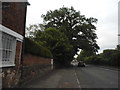
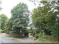
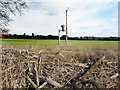

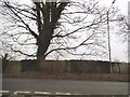
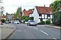
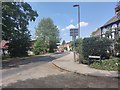
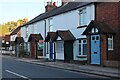
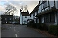
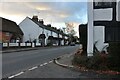
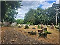
25 photos from this area
Area Information
Key information about the SL8 5PL including its size, population, and administrative classification.
- Area Type
- Postcode
- Area Size
- 10.3 hectares
- Population
- 1462
- Population Density
- 108 people/km²
House Prices in SL8 5PL
13
Properties
£633,564
Average Sold Price
£245,000
Lowest Price
£1,180,000
Highest Price
Showing 13 properties
| Address | Type | Beds | Baths | Last Sale Price | Last Sale Date | |
|---|---|---|---|---|---|---|
| The Cottage, Marlow Road, Bourne End, SL8 5PL | Semi-detached | 3 | 1 | £699,950 | Jul 2017 | |
| The Old Chapel, Marlow Road, Bourne End, SL8 5PL | house | - | - | £750,000 | Feb 2016 | |
| Malt Cottage, Marlow Road, Bourne End, SL8 5PL | house | 5 | - | £650,000 | Nov 2013 | |
| Jasmyne Cottage, Marlow Road, Bourne End, SL8 5PL | Semi-detached | - | - | £245,000 | Sep 2009 | |
| The Friary, Marlow Road, Bourne End, SL8 5PL | house | - | - | £640,000 | Sep 2009 | |
| Vine Leigh House, Marlow Road, Bourne End, SL8 5PL | Semi-detached | - | - | £1,180,000 | Oct 2007 | |
| Clarence Cottage, Marlow Road, Bourne End, SL8 5PL | Detached | 5 | 3 | £270,000 | Feb 1997 | |
| Abbots Willow, Marlow Road, Bourne End, SL8 5PL | Terraced | 3 | 2 | - | - | |
| The Old Malt House, Marlow Road, Bourne End, SL8 5PL | house | 7 | 4 | - | - | |
| Accommodation Above, The Black Lion, Marlow Road, Bourne End, SL8 5PL | Flat | - | - | - | - |
Page 1 of 2
Energy Efficiency in SL8 5PL
Amenities
Schools
| Rank | School | Type | Entry gender | Ages |
|---|
Explore more schools in this area
Go to Schools tabDemographics
Household Size
Two person
most common
Accommodation Type
Houses
most common
Tenure
87
majority
Ethnic Group
White
most common
Religion
N/A
most common
Household Composition
N/A
most common
Age
47
median
Adults (30-64 years)
most common
Household Deprivation
N/A
with no deprivation
NS-SEC
52
in Lower managerial occupations
Explore more demographic insights in this area
Go to Demographics tabPlanning
Planning Constraints
- Flood RiskPremium
- Ramsar Wetland SitesPremium
- Area of Outstanding Natural BeautyPremium
- Protected Nature ReservePremium
- Protected WoodlandPremium