Area Overview for SL8 5PS
Photos of SL8 5PS

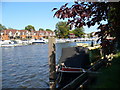
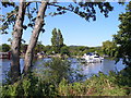
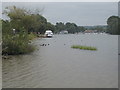

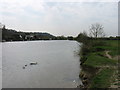
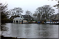
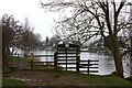

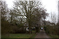
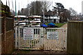
94 photos from this area
Area Information
Key information about the SL8 5PS including its size, population, and administrative classification.
- Area Type
- Postcode
- Area Size
- 38.6 hectares
- Population
- 1462
- Population Density
- 108 people/km²
House Prices in SL8 5PS
41
Properties
£812,912
Average Sold Price
£250,000
Lowest Price
£1,400,000
Highest Price
Showing 41 properties
| Address | Type | Beds | Baths | Last Sale Price | Last Sale Date | |
|---|---|---|---|---|---|---|
| Nutmeg, Coldmoorholme Lane, Bourne End, SL8 5PS | Detached | 4 | 2 | £1,005,000 | Jan 2025 | |
| Littlefield, Coldmoorholme Lane, Bourne End, SL8 5PS | house | - | - | £1,350,000 | Dec 2024 | |
| The Paddock, Coldmoorholme Lane, Bourne End, SL8 5PS | Bungalow | - | - | £900,000 | Sep 2021 | |
| Spade Oak Cottage, Coldmoorholme Lane, Bourne End, SL8 5PS | Detached | 4 | 2 | £1,325,000 | Jan 2021 | |
| Moorholm, Coldmoorholme Lane, Bourne End, SL8 5PS | Detached | 4 | - | £875,000 | Jul 2019 | |
| Wayside Cottage, Coldmoorholme Lane, Bourne End, SL8 5PS | Semi-detached | - | - | £334,500 | Oct 2018 | |
| Newfields, Coldmoorholme Lane, Bourne End, SL8 5PS | Detached | 6 | 3 | £1,150,000 | Oct 2018 | |
| Old Thatch, Coldmoorholme Lane, Bourne End, SL8 5PS | Detached | 4 | 2 | £1,400,000 | Sep 2017 | |
| Cedar Lodge, Coldmoorholme Lane, Bourne End, SL8 5PS | Detached | 6 | - | £1,120,000 | Jun 2017 | |
| Rafters, Coldmoorholme Lane, Bourne End, SL8 5PS | Detached | 4 | 2 | £715,000 | Apr 2017 |
Page 1 of 5
Energy Efficiency in SL8 5PS
Amenities
Schools
| Rank | School | Type | Entry gender | Ages |
|---|
Explore more schools in this area
Go to Schools tabDemographics
Household Size
Two person
most common
Accommodation Type
Houses
most common
Tenure
87
majority
Ethnic Group
White
most common
Religion
N/A
most common
Household Composition
N/A
most common
Age
47
median
Adults (30-64 years)
most common
Household Deprivation
N/A
with no deprivation
NS-SEC
52
in Lower managerial occupations
Explore more demographic insights in this area
Go to Demographics tabPlanning
Planning Constraints
- Flood RiskPremium
- Ramsar Wetland SitesPremium
- Area of Outstanding Natural BeautyPremium
- Protected Nature ReservePremium
- Protected WoodlandPremium