Area Overview for SL8 5JE
Photos of SL8 5JE

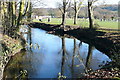
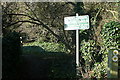
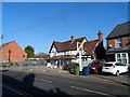
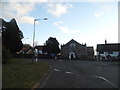
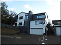
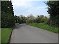
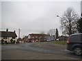
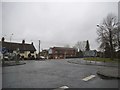
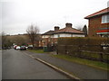
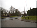

48 photos from this area
Area Information
Key information about the SL8 5JE including its size, population, and administrative classification.
- Area Type
- Postcode
- Area Size
- 6.0 hectares
- Population
- 1471
- Population Density
- 442 people/km²
House Prices in SL8 5JE
17
Properties
£940,221
Average Sold Price
£451,150
Lowest Price
£1,800,000
Highest Price
Showing 17 properties
| Address | Type | Beds | Baths | Last Sale Price | Last Sale Date | |
|---|---|---|---|---|---|---|
| White Horse Cottage, Kiln Lane, Bourne End, SL8 5JE | Cottage | 4 | 2 | £1,130,000 | Jul 2023 | |
| Timaru, Kiln Lane, Bourne End, SL8 5JE | Detached | 5 | 2 | £1,275,000 | Apr 2022 | |
| FORMOSO, KILN LANE, Bourne End, SL8 5JE | Detached | - | - | £1,800,000 | Dec 2021 | |
| Orchard Lea Cottage, Kiln Lane, Bourne End, SL8 5JE | house | - | - | £1,190,000 | Aug 2021 | |
| Honey Wood, Kiln Lane, Bourne End, SL8 5JE | Bungalow | - | - | £700,000 | Aug 2020 | |
| Hillside House, Kiln Lane, Bourne End, SL8 5JE | Detached | 6 | 6 | £975,000 | May 2019 | |
| Arlberg House, Kiln Lane, Bourne End, SL8 5JE | house | - | - | £825,000 | Dec 2016 | |
| Katonah, Kiln Lane, Bourne End, SL8 5JE | house | 4 | - | £860,000 | Dec 2012 | |
| Wood Lodge, Kiln Lane, Bourne End, SL8 5JE | Detached | - | - | £741,500 | May 2006 | |
| Aston House, Kiln Lane, Bourne End, SL8 5JE | Detached | 6 | 5 | £660,000 | Jul 2003 |
Page 1 of 2
Energy Efficiency in SL8 5JE
Amenities
Schools
| Rank | School | Type | Entry gender | Ages |
|---|
Explore more schools in this area
Go to Schools tabDemographics
Household Size
Two person
most common
Accommodation Type
Houses
most common
Tenure
75
majority
Ethnic Group
White
most common
Religion
N/A
most common
Household Composition
N/A
most common
Age
47
median
Adults (30-64 years)
most common
Household Deprivation
N/A
with no deprivation
NS-SEC
50
in Lower managerial occupations
Explore more demographic insights in this area
Go to Demographics tabPlanning
Planning Constraints
- Flood RiskPremium
- Ramsar Wetland SitesPremium
- Area of Outstanding Natural BeautyPremium
- Protected Nature ReservePremium
- Protected WoodlandPremium