Area Overview for SL7 1TS
Photos of SL7 1TS

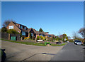
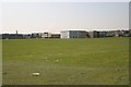
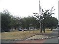
25 photos from this area
Area Information
Key information about the SL7 1TS including its size, population, and administrative classification.
- Area Type
- Postcode
- Area Size
- 1.4 hectares
- Population
- 1478
- Population Density
- 4400 people/km²
House Prices in SL7 1TS
43
Properties
£309,047
Average Sold Price
£162,000
Lowest Price
£535,000
Highest Price
Showing 43 properties
| Address | Type | Beds | Baths | Last Sale Price | Last Sale Date | |
|---|---|---|---|---|---|---|
| 5 James Close, Marlow, SL7 1TS | Terraced | 3 | 1 | £465,000 | Sep 2025 | |
| 27 James Close, Marlow, SL7 1TS | Maisonette | 2 | 1 | £255,000 | May 2025 | |
| 16 James Close, Marlow, SL7 1TS | Terraced | 4 | 2 | £535,000 | Nov 2024 | |
| 15 James Close, Marlow, SL7 1TS | Terraced | 4 | 1 | £500,000 | Sep 2024 | |
| 17 James Close, Marlow, SL7 1TS | Terraced | 3 | 1 | £400,000 | Dec 2022 | |
| 30 James Close, Marlow, SL7 1TS | Maisonette | 2 | 1 | £320,000 | May 2022 | |
| 10 James Close, Marlow, SL7 1TS | Maisonette | 1 | 1 | £225,000 | Dec 2021 | |
| 33 James Close, Marlow, SL7 1TS | Maisonette | - | - | £282,000 | Jul 2021 | |
| 12 James Close, Marlow, SL7 1TS | Terraced | 3 | 1 | £355,000 | Jun 2019 | |
| 13 James Close, Marlow, SL7 1TS | Terraced | 3 | 1 | £340,000 | Apr 2018 |
Page 1 of 5
Energy Efficiency in SL7 1TS
Amenities
Schools
| Rank | School | Type | Entry gender | Ages |
|---|
Explore more schools in this area
Go to Schools tabDemographics
Household Size
Family (3-5 people)
most common
Accommodation Type
Houses
most common
Tenure
58
majority
Ethnic Group
White
most common
Religion
N/A
most common
Household Composition
N/A
most common
Age
47
median
Adults (30-64 years)
most common
Household Deprivation
N/A
with no deprivation
NS-SEC
39
in Lower managerial occupations
Explore more demographic insights in this area
Go to Demographics tabPlanning
Planning Constraints
- Flood RiskPremium
- Ramsar Wetland SitesPremium
- Area of Outstanding Natural BeautyPremium
- Protected Nature ReservePremium
- Protected WoodlandPremium