Area Overview for SL7 1TU
Photos of SL7 1TU

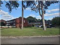
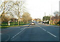
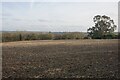
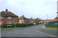
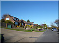
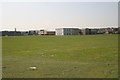
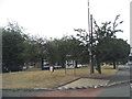
25 photos from this area
Area Information
Key information about the SL7 1TU including its size, population, and administrative classification.
- Area Type
- Postcode
- Area Size
- 9474 m²
- Population
- 1478
- Population Density
- 4400 people/km²
House Prices in SL7 1TU
30
Properties
£255,300
Average Sold Price
£80,000
Lowest Price
£430,000
Highest Price
Showing 30 properties
| Address | Type | Beds | Baths | Last Sale Price | Last Sale Date | |
|---|---|---|---|---|---|---|
| 34 Eliot Drive, Marlow, SL7 1TU | house | 2 | 1 | £430,000 | Apr 2024 | |
| 40 Eliot Drive, Marlow, SL7 1TU | Terraced | 3 | - | £330,000 | Dec 2019 | |
| 22 Eliot Drive, Marlow, SL7 1TU | house | - | - | £370,000 | Sep 2017 | |
| 46 Eliot Drive, Marlow, SL7 1TU | Semi-detached | 3 | 1 | £345,000 | Dec 2015 | |
| 16 Eliot Drive, Marlow, SL7 1TU | Terraced | 3 | 1 | £339,950 | Nov 2015 | |
| 6 Eliot Drive, Marlow, SL7 1TU | house | - | - | £305,000 | Oct 2015 | |
| 18 Eliot Drive, Marlow, SL7 1TU | house | 3 | - | £218,000 | Dec 2011 | |
| 38 Eliot Drive, Marlow, SL7 1TU | Detached | 3 | 2 | £235,000 | Jul 2008 | |
| 20 Eliot Drive, Marlow, SL7 1TU | Terraced | - | - | £250,000 | May 2007 | |
| 2 Eliot Drive, Marlow, SL7 1TU | Terraced | 3 | 1 | £178,000 | Jan 2004 |
Page 1 of 3
Energy Efficiency in SL7 1TU
Amenities
Schools
| Rank | School | Type | Entry gender | Ages |
|---|
Explore more schools in this area
Go to Schools tabDemographics
Household Size
Family (3-5 people)
most common
Accommodation Type
Houses
most common
Tenure
58
majority
Ethnic Group
White
most common
Religion
N/A
most common
Household Composition
N/A
most common
Age
47
median
Adults (30-64 years)
most common
Household Deprivation
N/A
with no deprivation
NS-SEC
39
in Lower managerial occupations
Explore more demographic insights in this area
Go to Demographics tabPlanning
Planning Constraints
- Flood RiskPremium
- Ramsar Wetland SitesPremium
- Area of Outstanding Natural BeautyPremium
- Protected Nature ReservePremium
- Protected WoodlandPremium