Area Overview for SL6 5DB
Photos of SL6 5DB
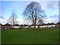
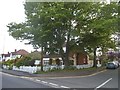
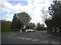
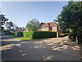
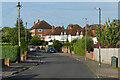
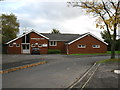
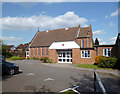
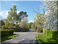


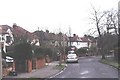
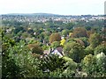
12 photos from this area
Area Information
Key information about the SL6 5DB including its size, population, and administrative classification.
- Area Type
- Postcode
- Area Size
- 5624 m²
- Population
- 1647
- Population Density
- 4244 people/km²
House Prices in SL6 5DB
15
Properties
£434,619
Average Sold Price
£143,000
Lowest Price
£820,000
Highest Price
Showing 15 properties
| Address | Type | Beds | Baths | Last Sale Price | Last Sale Date | |
|---|---|---|---|---|---|---|
| 28 St Marks Crescent, Maidenhead, SL6 5DB | Semi-detached | 4 | 1 | £690,000 | Aug 2024 | |
| 18 St Marks Crescent, Maidenhead, SL6 5DB | Detached | 4 | 2 | £820,000 | Jan 2020 | |
| 16 St Marks Crescent, Maidenhead, SL6 5DB | Detached | 3 | - | £640,000 | Oct 2016 | |
| 12 St Marks Crescent, Maidenhead, SL6 5DB | house | 4 | - | £445,000 | Oct 2011 | |
| 14 St Marks Crescent, Maidenhead, SL6 5DB | Detached | - | - | £335,000 | Sep 2003 | |
| 10 St Marks Crescent, Maidenhead, SL6 5DB | Semi-detached | 2 | 1 | £231,000 | Jun 2001 | |
| 24 St Marks Crescent, Maidenhead, SL6 5DB | Semi-detached | - | - | £143,000 | Nov 1998 | |
| 20 St Marks Crescent, Maidenhead, SL6 5DB | Detached | - | - | £172,950 | Oct 1997 | |
| 2B St Marks Crescent, Maidenhead, SL6 5DB | Detached | 2 | 1 | - | - | |
| 6A St Marks Crescent, Maidenhead, SL6 5DB | Detached | 3 | 1 | - | - |
Page 1 of 2
Energy Efficiency in SL6 5DB
Amenities
Schools
| Rank | School | Type | Entry gender | Ages |
|---|
Explore more schools in this area
Go to Schools tabDemographics
Household Size
Family (3-5 people)
most common
Accommodation Type
Houses
most common
Tenure
69
majority
Ethnic Group
White
most common
Religion
N/A
most common
Household Composition
N/A
most common
Age
47
median
Adults (30-64 years)
most common
Household Deprivation
N/A
with no deprivation
NS-SEC
47
in Lower managerial occupations
Explore more demographic insights in this area
Go to Demographics tabPlanning
Planning Constraints
- Flood RiskPremium
- Ramsar Wetland SitesPremium
- Area of Outstanding Natural BeautyPremium
- Protected Nature ReservePremium
- Protected WoodlandPremium