Area Overview for SL6 5DA
Photos of SL6 5DA

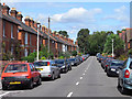
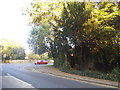
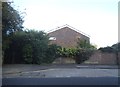
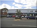

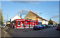
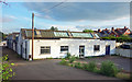
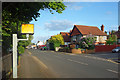

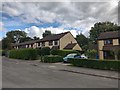
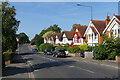
23 photos from this area
Area Information
Key information about the SL6 5DA including its size, population, and administrative classification.
- Area Type
- Postcode
- Area Size
- 2753 m²
- Population
- 1647
- Population Density
- 4244 people/km²
House Prices in SL6 5DA
9
Properties
£1,220,000
Average Sold Price
£1,220,000
Lowest Price
£1,220,000
Highest Price
Showing 9 properties
| Address | Type | Beds | Baths | Last Sale Price | Last Sale Date | |
|---|---|---|---|---|---|---|
| 5 ST MARKS CRESCENT, Maidenhead, SL6 5DA | Detached | 3 | 1 | £1,220,000 | Oct 2022 | |
| 13A St Marks Crescent, Maidenhead, SL6 5DA | Flat | 1 | 1 | - | - | |
| Haka Chinese Takeaway, 5B St Marks Crescent, Maidenhead, SL6 5DA | restaurant_cafe | - | - | - | - | |
| Kebab Van, St Marks Crescent, Maidenhead, SL6 5DA | Retail | - | - | - | - | |
| 15A St Marks Crescent, Maidenhead, SL6 5DA | Maisonette | - | - | - | - | |
| 7A St Marks Crescent, Maidenhead, SL6 5DA | Flat | 2 | 1 | - | - | |
| 9A St Marks Crescent, Maidenhead, SL6 5DA | Flat | 2 | 1 | - | - | |
| St Marks Church Hall, St Marks Crescent, Maidenhead, SL6 5DA | commercial | - | - | - | - | |
| 13B St Marks Crescent, Maidenhead, SL6 5DA | Flat | - | - | - | - |
Energy Efficiency in SL6 5DA
Amenities
Schools
| Rank | School | Type | Entry gender | Ages |
|---|
Explore more schools in this area
Go to Schools tabDemographics
Household Size
Family (3-5 people)
most common
Accommodation Type
Houses
most common
Tenure
69
majority
Ethnic Group
White
most common
Religion
N/A
most common
Household Composition
N/A
most common
Age
47
median
Adults (30-64 years)
most common
Household Deprivation
N/A
with no deprivation
NS-SEC
47
in Lower managerial occupations
Explore more demographic insights in this area
Go to Demographics tabPlanning
Planning Constraints
- Flood RiskPremium
- Ramsar Wetland SitesPremium
- Area of Outstanding Natural BeautyPremium
- Protected Nature ReservePremium
- Protected WoodlandPremium