Area Overview for SL5 7AR
Photos of SL5 7AR
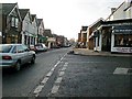
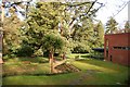
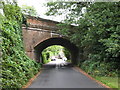
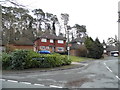
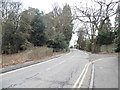
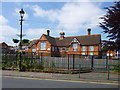
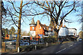
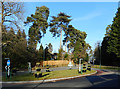
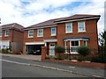
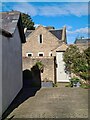
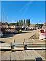

36 photos from this area
Area Information
Key information about the SL5 7AR including its size, population, and administrative classification.
- Area Type
- Postcode
- Area Size
- 4758 m²
- Population
- 1670
- Population Density
- 2547 people/km²
House Prices in SL5 7AR
14
Properties
£373,018
Average Sold Price
£135,000
Lowest Price
£620,000
Highest Price
Showing 14 properties
| Address | Type | Beds | Baths | Last Sale Price | Last Sale Date | |
|---|---|---|---|---|---|---|
| 6 Farm Close, Ascot, SL5 7AR | Semi-detached | 2 | 1 | £515,000 | Jun 2023 | |
| 2 Farm Close, Ascot, SL5 7AR | Semi-detached | 3 | 2 | £425,000 | Sep 2020 | |
| 5 Farm Close, Ascot, SL5 7AR | Semi-detached | 3 | 2 | £620,000 | Nov 2017 | |
| 12 Farm Close, Ascot, SL5 7AR | Semi-detached | 3 | - | £600,000 | Jul 2014 | |
| 1 Farm Close, Ascot, SL5 7AR | Semi-detached | 2 | - | £399,000 | Jul 2014 | |
| 10 Farm Close, Ascot, SL5 7AR | Semi-detached | 2 | - | £289,950 | Sep 2010 | |
| 9 Farm Close, Ascot, SL5 7AR | Detached | 3 | 2 | £337,500 | Jun 2007 | |
| 7 Farm Close, Ascot, SL5 7AR | Semi-detached | - | - | £360,000 | Oct 2006 | |
| 4 Farm Close, Ascot, SL5 7AR | Semi-detached | - | - | £263,750 | Jun 2006 | |
| Spring Cottage, 11 Farm Close, Ascot, SL5 7AR | Semi-detached | - | - | £135,000 | May 1999 |
Page 1 of 2
Energy Efficiency in SL5 7AR
Amenities
Schools
| Rank | School | Type | Entry gender | Ages |
|---|
Explore more schools in this area
Go to Schools tabDemographics
Household Size
Family (3-5 people)
most common
Accommodation Type
Houses
most common
Tenure
80
majority
Ethnic Group
White
most common
Religion
N/A
most common
Household Composition
N/A
most common
Age
47
median
Adults (30-64 years)
most common
Household Deprivation
N/A
with no deprivation
NS-SEC
54
in Lower managerial occupations
Explore more demographic insights in this area
Go to Demographics tabPlanning
Planning Constraints
- Flood RiskPremium
- Ramsar Wetland SitesPremium
- Area of Outstanding Natural BeautyPremium
- Protected Nature ReservePremium
- Protected WoodlandPremium