Area Overview for SL5 7AP
Photos of SL5 7AP
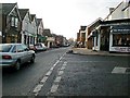
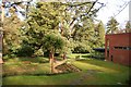
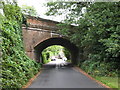
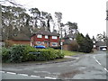
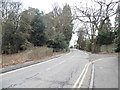
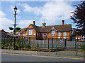
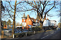
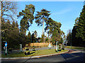
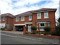
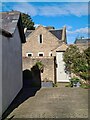
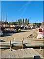

36 photos from this area
Area Information
Key information about the SL5 7AP including its size, population, and administrative classification.
- Area Type
- Postcode
- Area Size
- 5519 m²
- Population
- 1952
- Population Density
- 1710 people/km²
House Prices in SL5 7AP
15
Properties
£442,875
Average Sold Price
£246,000
Lowest Price
£682,000
Highest Price
Showing 15 properties
| Address | Type | Beds | Baths | Last Sale Price | Last Sale Date | |
|---|---|---|---|---|---|---|
| 97 Lower Village Road, Ascot, SL5 7AP | Terraced | 2 | 1 | £682,000 | Oct 2022 | |
| 83 Lower Village Road, Ascot, SL5 7AP | house | 2 | - | £380,000 | Nov 2021 | |
| 101 Lower Village Road, Ascot, SL5 7AP | Semi-detached | 3 | 1 | £585,000 | Jun 2019 | |
| 89 Lower Village Road, Ascot, SL5 7AP | Bungalow | - | - | £499,999 | Sep 2014 | |
| 95 Lower Village Road, Ascot, SL5 7AP | Cottage | 3 | - | £380,000 | Jun 2013 | |
| 99 Lower Village Road, Ascot, SL5 7AP | house | - | - | £420,000 | Dec 2005 | |
| 91 Lower Village Road, Ascot, SL5 7AP | Detached | 3 | 1 | £350,000 | Nov 2005 | |
| 79 Lower Village Road, Ascot, SL5 7AP | Semi-detached | - | - | £246,000 | Apr 2004 | |
| 103 Lower Village Road, Ascot, SL5 7AP | Detached | 3 | 2 | - | - | |
| Mobile Home, 91 Lower Village Road, Ascot, SL5 7AP | Mobile Home | - | - | - | - |
Page 1 of 2
Energy Efficiency in SL5 7AP
Amenities
Schools
| Rank | School | Type | Entry gender | Ages |
|---|
Explore more schools in this area
Go to Schools tabDemographics
Household Size
Family (3-5 people)
most common
Accommodation Type
Houses
most common
Tenure
59
majority
Ethnic Group
White
most common
Religion
N/A
most common
Household Composition
N/A
most common
Age
47
median
Adults (30-64 years)
most common
Household Deprivation
N/A
with no deprivation
NS-SEC
45
in Lower managerial occupations
Explore more demographic insights in this area
Go to Demographics tabPlanning
Planning Constraints
- Flood RiskPremium
- Ramsar Wetland SitesPremium
- Area of Outstanding Natural BeautyPremium
- Protected Nature ReservePremium
- Protected WoodlandPremium