Area Overview for SL3 8PF
Photos of SL3 8PF
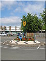

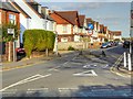


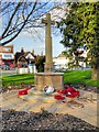

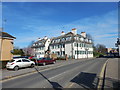


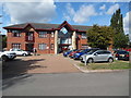
43 photos from this area
Area Information
Key information about the SL3 8PF including its size, population, and administrative classification.
- Area Type
- Postcode
- Area Size
- 6855 m²
- Population
- 1864
- Population Density
- 4251 people/km²
House Prices in SL3 8PF
25
Properties
£258,399
Average Sold Price
£170,000
Lowest Price
£515,000
Highest Price
Showing 25 properties
| Address | Type | Beds | Baths | Last Sale Price | Last Sale Date | |
|---|---|---|---|---|---|---|
| 1, Thornhill Court, Maplin Park, Slough, SL3 8PF | Semi-detached | 4 | 3 | £515,000 | Aug 2025 | |
| 19, Thornhill Court, Maplin Park, Slough, SL3 8PF | Flat | 2 | 2 | £275,000 | Jul 2022 | |
| 11, Thornhill Court, Maplin Park, Slough, SL3 8PF | Flat | 2 | 2 | £296,000 | Dec 2017 | |
| 5, Thornhill Court, Maplin Park, Slough, SL3 8PF | house | 4 | - | £455,000 | Apr 2017 | |
| 17, Thornhill Court, Maplin Park, Slough, SL3 8PF | Flat | - | - | £197,500 | Apr 2014 | |
| 2, Thornhill Court, Maplin Park, Slough, SL3 8PF | Terraced | 4 | - | £275,000 | Feb 2014 | |
| 6, Thornhill Court, Maplin Park, Slough, SL3 8PF | Terraced | 4 | 3 | £287,500 | Dec 2012 | |
| 12, Thornhill Court, Maplin Park, Slough, SL3 8PF | Flat | - | - | £180,000 | Sep 2012 | |
| 3, Thornhill Court, Maplin Park, Slough, SL3 8PF | house | 3 | 3 | £250,000 | May 2010 | |
| 20, Thornhill Court, Maplin Park, Slough, SL3 8PF | Flat | 2 | 2 | £179,995 | Apr 2010 |
Page 1 of 3
Energy Efficiency in SL3 8PF
Amenities
Schools
| Rank | School | Type | Entry gender | Ages |
|---|
Explore more schools in this area
Go to Schools tabDemographics
Household Size
Family (3-5 people)
most common
Accommodation Type
Flats
most common
Tenure
41
majority
Ethnic Group
White
most common
Religion
N/A
most common
Household Composition
N/A
most common
Age
47
median
Adults (30-64 years)
most common
Household Deprivation
N/A
with no deprivation
NS-SEC
35
in Lower managerial occupations
Explore more demographic insights in this area
Go to Demographics tabPlanning
Planning Constraints
- Flood RiskPremium
- Ramsar Wetland SitesPremium
- Area of Outstanding Natural BeautyPremium
- Protected Nature ReservePremium
- Protected WoodlandPremium