Area Overview for SL3 7FE
Photos of SL3 7FE
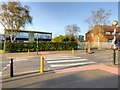
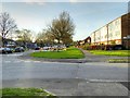
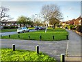

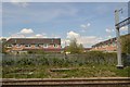
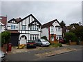
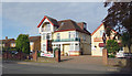
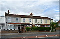
37 photos from this area
Area Information
Key information about the SL3 7FE including its size, population, and administrative classification.
- Area Type
- Postcode
- Area Size
- 1.1 hectares
- Population
- 2097
- Population Density
- 5257 people/km²
House Prices in SL3 7FE
54
Properties
£214,411
Average Sold Price
£112,995
Lowest Price
£480,000
Highest Price
Showing 54 properties
| Address | Type | Beds | Baths | Last Sale Price | Last Sale Date | |
|---|---|---|---|---|---|---|
| 18 Hurworth Avenue, Slough, SL3 7FE | Flat | 2 | 2 | £280,000 | Sep 2025 | |
| 20 Hurworth Avenue, Slough, SL3 7FE | Flat | 2 | 2 | £280,000 | Jun 2025 | |
| 32 Hurworth Avenue, Slough, SL3 7FE | Flat | 2 | 2 | £290,000 | Jun 2025 | |
| 61 Hurworth Avenue, Slough, SL3 7FE | Flat | 2 | 2 | £260,000 | Mar 2025 | |
| 9 Hurworth Avenue, Slough, SL3 7FE | Flat | - | - | £250,000 | Mar 2025 | |
| 49 Hurworth Avenue, Slough, SL3 7FE | Flat | 2 | 2 | £277,500 | Feb 2025 | |
| 25 Hurworth Avenue, Slough, SL3 7FE | Flat | - | - | £210,000 | Dec 2022 | |
| 4 Hurworth Avenue, Slough, SL3 7FE | Flat | 2 | 2 | £280,000 | Jul 2022 | |
| 44 Hurworth Avenue, Slough, SL3 7FE | Semi-detached | 3 | 1 | £480,000 | Feb 2022 | |
| 43 Hurworth Avenue, Slough, SL3 7FE | Terraced | 2 | 2 | £415,000 | Dec 2021 |
Page 1 of 6
Energy Efficiency in SL3 7FE
Amenities
Schools
| Rank | School | Type | Entry gender | Ages |
|---|
Explore more schools in this area
Go to Schools tabDemographics
Household Size
Family (3-5 people)
most common
Accommodation Type
Houses
most common
Tenure
74
majority
Ethnic Group
asian_total
most common
Religion
N/A
most common
Household Composition
N/A
most common
Age
47
median
Adults (30-64 years)
most common
Household Deprivation
N/A
with no deprivation
NS-SEC
39
in Lower managerial occupations
Explore more demographic insights in this area
Go to Demographics tabPlanning
Planning Constraints
- Flood RiskPremium
- Ramsar Wetland SitesPremium
- Area of Outstanding Natural BeautyPremium
- Protected Nature ReservePremium
- Protected WoodlandPremium