Area Overview for SL2 3UD
Photos of SL2 3UD
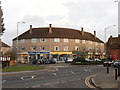
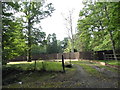
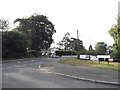
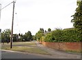
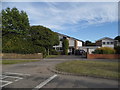
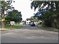
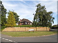
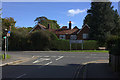
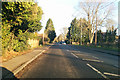
27 photos from this area
Area Information
Key information about the SL2 3UD including its size, population, and administrative classification.
- Area Type
- Postcode
- Area Size
- 1.7 hectares
- Population
- 1922
- Population Density
- 1388 people/km²
House Prices in SL2 3UD
21
Properties
£647,954
Average Sold Price
£225,000
Lowest Price
£1,200,000
Highest Price
Showing 21 properties
| Address | Type | Beds | Baths | Last Sale Price | Last Sale Date | |
|---|---|---|---|---|---|---|
| 33 Crispin Way, Farnham Common, SL2 3UD | Detached | 5 | 3 | £1,200,000 | Jan 2025 | |
| 35 Crispin Way, Farnham Common, SL2 3UD | house | - | - | £795,000 | Jan 2022 | |
| 41 Crispin Way, Farnham Common, SL2 3UD | Detached | - | - | £825,000 | Nov 2020 | |
| 43 Crispin Way, Farnham Common, SL2 3UD | house | - | - | £675,000 | Oct 2019 | |
| 21 Crispin Way, Farnham Common, SL2 3UD | Detached | 4 | 1 | £780,000 | Jan 2016 | |
| 7 Crispin Way, Farnham Common, SL2 3UD | Detached | 3 | 3 | £690,000 | Aug 2014 | |
| 9 Crispin Way, Farnham Common, SL2 3UD | Detached | 4 | 4 | £690,000 | Dec 2012 | |
| 27 Crispin Way, Farnham Common, SL2 3UD | house | 3 | - | £479,950 | Nov 2006 | |
| 1 Crispin Way, Farnham Common, SL2 3UD | Detached | - | - | £560,000 | Jul 2006 | |
| 3 Crispin Way, Farnham Common, SL2 3UD | Detached | - | - | £426,500 | Sep 2005 |
Page 1 of 3
Energy Efficiency in SL2 3UD
Amenities
Schools
| Rank | School | Type | Entry gender | Ages |
|---|
Explore more schools in this area
Go to Schools tabDemographics
Household Size
Family (3-5 people)
most common
Accommodation Type
Houses
most common
Tenure
85
majority
Ethnic Group
White
most common
Religion
N/A
most common
Household Composition
N/A
most common
Age
47
median
Adults (30-64 years)
most common
Household Deprivation
N/A
with no deprivation
NS-SEC
53
in Lower managerial occupations
Explore more demographic insights in this area
Go to Demographics tabPlanning
Planning Constraints
- Flood RiskPremium
- Ramsar Wetland SitesPremium
- Area of Outstanding Natural BeautyPremium
- Protected Nature ReservePremium
- Protected WoodlandPremium