Area Overview for SL2 2PR
Photos of SL2 2PR
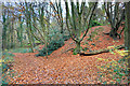
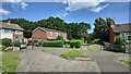
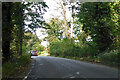
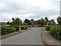
20 photos from this area
Area Information
Key information about the SL2 2PR including its size, population, and administrative classification.
- Area Type
- Postcode
- Area Size
- 5644 m²
- Population
- 1711
- Population Density
- 4344 people/km²
House Prices in SL2 2PR
21
Properties
£290,375
Average Sold Price
£174,000
Lowest Price
£425,000
Highest Price
Showing 21 properties
| Address | Type | Beds | Baths | Last Sale Price | Last Sale Date | |
|---|---|---|---|---|---|---|
| 276 Long Furlong Drive, Slough, SL2 2PR | house | - | - | £300,000 | Apr 2025 | |
| 286 Long Furlong Drive, Slough, SL2 2PR | Terraced | 3 | 2 | £425,000 | Dec 2024 | |
| 300 Long Furlong Drive, Slough, SL2 2PR | Terraced | 3 | 1 | £365,000 | Jan 2024 | |
| 288 Long Furlong Drive, Slough, SL2 2PR | house | - | - | £325,000 | Oct 2021 | |
| 302 Long Furlong Drive, Slough, SL2 2PR | Terraced | 3 | 1 | £342,500 | Feb 2021 | |
| 310 Long Furlong Drive, Slough, SL2 2PR | Terraced | 3 | 1 | £217,500 | Sep 2014 | |
| 308 Long Furlong Drive, Slough, SL2 2PR | house | - | - | £174,000 | Sep 2010 | |
| 282 Long Furlong Drive, Slough, SL2 2PR | house | - | - | £174,000 | Dec 2009 | |
| 306 Long Furlong Drive, Slough, SL2 2PR | Semi-detached | - | - | - | - | |
| 272 Long Furlong Drive, Slough, SL2 2PR | house | - | - | - | - |
Page 1 of 3
Energy Efficiency in SL2 2PR
Amenities
Schools
| Rank | School | Type | Entry gender | Ages |
|---|
Explore more schools in this area
Go to Schools tabDemographics
Household Size
Family (3-5 people)
most common
Accommodation Type
Houses
most common
Tenure
59
majority
Ethnic Group
White
most common
Religion
N/A
most common
Household Composition
N/A
most common
Age
47
median
Adults (30-64 years)
most common
Household Deprivation
N/A
with no deprivation
NS-SEC
28
in Lower managerial occupations
Explore more demographic insights in this area
Go to Demographics tabPlanning
Planning Constraints
- Flood RiskPremium
- Ramsar Wetland SitesPremium
- Area of Outstanding Natural BeautyPremium
- Protected Nature ReservePremium
- Protected WoodlandPremium