Area Overview for SL1 2TQ
Photos of SL1 2TQ
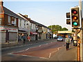
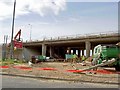
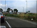
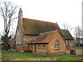


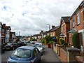
69 photos from this area
Area Information
Key information about the SL1 2TQ including its size, population, and administrative classification.
- Area Type
- Postcode
- Area Size
- 5487 m²
- Population
- 1971
- Population Density
- 6185 people/km²
House Prices in SL1 2TQ
26
Properties
£234,390
Average Sold Price
£82,000
Lowest Price
£400,000
Highest Price
Showing 26 properties
| Address | Type | Beds | Baths | Last Sale Price | Last Sale Date | |
|---|---|---|---|---|---|---|
| 211 Chalvey Grove, Slough, SL1 2TQ | Semi-detached | 2 | 2 | £390,000 | Feb 2023 | |
| 225 Chalvey Grove, Slough, SL1 2TQ | Terraced | 4 | - | £348,000 | Jun 2021 | |
| 209AA, Chalvey Grove, Slough, SL1 2TQ | Detached | 3 | 1 | £400,000 | Apr 2021 | |
| 205 Chalvey Grove, Slough, SL1 2TQ | house | 3 | - | £216,185 | Oct 2020 | |
| 207 Chalvey Grove, Slough, SL1 2TQ | house | 1 | - | £285,000 | Oct 2015 | |
| 215 Chalvey Grove, Slough, SL1 2TQ | Terraced | 2 | - | £190,000 | Feb 2015 | |
| 209 Chalvey Grove, Slough, SL1 2TQ | house | - | - | £185,000 | Aug 2012 | |
| 219 Chalvey Grove, Slough, SL1 2TQ | house | - | - | £173,000 | Mar 2010 | |
| 213A Chalvey Grove, Slough, SL1 2TQ | Detached | - | - | £225,000 | Nov 2009 | |
| 201 Chalvey Grove, Slough, SL1 2TQ | Terraced | 3 | 2 | £189,500 | Aug 2007 |
Page 1 of 3
Energy Efficiency in SL1 2TQ
Amenities
Schools
| Rank | School | Type | Entry gender | Ages |
|---|
Explore more schools in this area
Go to Schools tabDemographics
Household Size
Family (3-5 people)
most common
Accommodation Type
Houses
most common
Tenure
59
majority
Ethnic Group
asian_total
most common
Religion
N/A
most common
Household Composition
N/A
most common
Age
47
median
Adults (30-64 years)
most common
Household Deprivation
N/A
with no deprivation
NS-SEC
29
in Lower managerial occupations
Explore more demographic insights in this area
Go to Demographics tabPlanning
Planning Constraints
- Flood RiskPremium
- Ramsar Wetland SitesPremium
- Area of Outstanding Natural BeautyPremium
- Protected Nature ReservePremium
- Protected WoodlandPremium