Area Overview for SL1 2SX
Photos of SL1 2SX
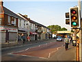
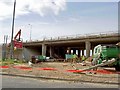
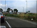
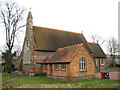


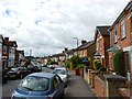
69 photos from this area
Area Information
Key information about the SL1 2SX including its size, population, and administrative classification.
- Area Type
- Postcode
- Area Size
- 2.0 hectares
- Population
- 2243
- Population Density
- 6582 people/km²
House Prices in SL1 2SX
46
Properties
£218,455
Average Sold Price
£56,000
Lowest Price
£425,000
Highest Price
Showing 46 properties
| Address | Type | Beds | Baths | Last Sale Price | Last Sale Date | |
|---|---|---|---|---|---|---|
| 15 Paxton Avenue, Slough, SL1 2SX | Semi-detached | 3 | 1 | £425,000 | May 2023 | |
| 81 Paxton Avenue, Slough, SL1 2SX | house | - | - | £410,000 | Mar 2021 | |
| 57 Paxton Avenue, Slough, SL1 2SX | Terraced | 3 | 1 | £355,000 | Nov 2018 | |
| 83 Paxton Avenue, Slough, SL1 2SX | Terraced | 3 | 1 | £327,000 | Jun 2018 | |
| 85 Paxton Avenue, Slough, SL1 2SX | Terraced | 3 | 1 | £310,000 | Mar 2018 | |
| 29 Paxton Avenue, Slough, SL1 2SX | Terraced | 3 | 1 | £325,000 | Nov 2017 | |
| 17 Paxton Avenue, Slough, SL1 2SX | Semi-detached | 4 | - | £422,000 | Jan 2017 | |
| 67 Paxton Avenue, Slough, SL1 2SX | Detached | 3 | - | £310,000 | Apr 2016 | |
| 45 Paxton Avenue, Slough, SL1 2SX | house | - | - | £262,000 | Feb 2015 | |
| 23 Paxton Avenue, Slough, SL1 2SX | Bungalow | - | - | £240,000 | Jul 2006 |
Page 1 of 5
Energy Efficiency in SL1 2SX
Amenities
Schools
| Rank | School | Type | Entry gender | Ages |
|---|
Explore more schools in this area
Go to Schools tabDemographics
Household Size
Family (3-5 people)
most common
Accommodation Type
Houses
most common
Tenure
52
majority
Ethnic Group
asian_total
most common
Religion
N/A
most common
Household Composition
N/A
most common
Age
47
median
Adults (30-64 years)
most common
Household Deprivation
N/A
with no deprivation
NS-SEC
22
in Lower managerial occupations
Explore more demographic insights in this area
Go to Demographics tabPlanning
Planning Constraints
- Flood RiskPremium
- Ramsar Wetland SitesPremium
- Area of Outstanding Natural BeautyPremium
- Protected Nature ReservePremium
- Protected WoodlandPremium