Area Overview for RH7 6BH
Photos of RH7 6BH
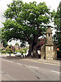
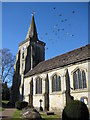
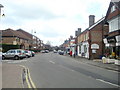

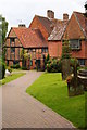

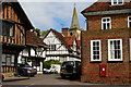
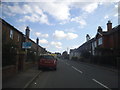
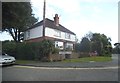
70 photos from this area
Area Information
Key information about the RH7 6BH including its size, population, and administrative classification.
- Area Type
- Postcode
- Area Size
- 1.8 hectares
- Population
- 1437
- Population Density
- 596 people/km²
House Prices in RH7 6BH
35
Properties
£429,913
Average Sold Price
£195,000
Lowest Price
£605,000
Highest Price
Showing 35 properties
| Address | Type | Beds | Baths | Last Sale Price | Last Sale Date | |
|---|---|---|---|---|---|---|
| 2 Mount Pleasant Road, Lingfield, RH7 6BH | Semi-detached | 3 | 1 | £470,000 | Jan 2025 | |
| 6 Mount Pleasant Road, Lingfield, RH7 6BH | Semi-detached | 3 | 1 | £450,000 | Oct 2024 | |
| 25 Mount Pleasant Road, Lingfield, RH7 6BH | Bungalow | 2 | 2 | £532,000 | Aug 2024 | |
| 27 Mount Pleasant Road, Lingfield, RH7 6BH | Bungalow | 3 | 1 | £526,500 | Sep 2023 | |
| 28 Mount Pleasant Road, Lingfield, RH7 6BH | Bungalow | 3 | 1 | £505,000 | Mar 2023 | |
| 33 Mount Pleasant Road, Lingfield, RH7 6BH | house | - | - | £431,000 | Mar 2021 | |
| 5 Mount Pleasant Road, Lingfield, RH7 6BH | house | - | - | £435,000 | Oct 2020 | |
| 32 Mount Pleasant Road, Lingfield, RH7 6BH | house | - | - | £385,000 | Aug 2019 | |
| 7 Mount Pleasant Road, Lingfield, RH7 6BH | Semi-detached | 3 | 1 | £438,500 | Apr 2019 | |
| 1 Mount Pleasant Road, Lingfield, RH7 6BH | Semi-detached | 3 | 2 | £530,000 | Feb 2019 |
Page 1 of 4
Energy Efficiency in RH7 6BH
Amenities
Schools
| Rank | School | Type | Entry gender | Ages |
|---|
Explore more schools in this area
Go to Schools tabDemographics
Household Size
One person
most common
Accommodation Type
Houses
most common
Tenure
63
majority
Ethnic Group
White
most common
Religion
N/A
most common
Household Composition
N/A
most common
Age
47
median
Adults (30-64 years)
most common
Household Deprivation
N/A
with no deprivation
NS-SEC
41
in Lower managerial occupations
Explore more demographic insights in this area
Go to Demographics tabPlanning
Planning Constraints
- Flood RiskPremium
- Ramsar Wetland SitesPremium
- Area of Outstanding Natural BeautyPremium
- Protected Nature ReservePremium
- Protected WoodlandPremium