Area Overview for RH6 9NS
Photos of RH6 9NS
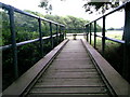
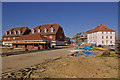
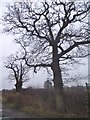
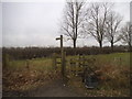
74 photos from this area
Area Information
Key information about the RH6 9NS including its size, population, and administrative classification.
- Area Type
- Postcode
- Area Size
- 2.4 hectares
- Population
- 2414
- Population Density
- 1337 people/km²
House Prices in RH6 9NS
57
Properties
£396,368
Average Sold Price
£297,995
Lowest Price
£521,000
Highest Price
Showing 57 properties
| Address | Type | Beds | Baths | Last Sale Price | Last Sale Date | |
|---|---|---|---|---|---|---|
| 155 Brookfield Drive, Horley, RH6 9NS | Terraced | 3 | 2 | £408,000 | Jul 2023 | |
| 131 Brookfield Drive, Horley, RH6 9NS | Semi-detached | 3 | 1 | £415,000 | Oct 2022 | |
| 83 Brookfield Drive, Horley, RH6 9NS | Terraced | 3 | 1 | £426,000 | Sep 2022 | |
| 139 Brookfield Drive, Horley, RH6 9NS | Terraced | 3 | 2 | £370,000 | Jun 2020 | |
| 157 Brookfield Drive, Horley, RH6 9NS | Terraced | 3 | 2 | £350,000 | Jun 2019 | |
| 137 Brookfield Drive, Horley, RH6 9NS | Terraced | 3 | 2 | £332,500 | Feb 2019 | |
| 85 Brookfield Drive, Horley, RH6 9NS | Semi-detached | 5 | 1 | £460,000 | Aug 2018 | |
| 75 Brookfield Drive, Horley, RH6 9NS | Terraced | 5 | 1 | £470,000 | Jul 2018 | |
| 95 Brookfield Drive, Horley, RH6 9NS | Semi-detached | 5 | 2 | £460,000 | Mar 2018 | |
| 163 Brookfield Drive, Horley, RH6 9NS | Semi-detached | 4 | 4 | £450,000 | Nov 2017 |
Page 1 of 6
Energy Efficiency in RH6 9NS
Amenities
Schools
| Rank | School | Type | Entry gender | Ages |
|---|
Explore more schools in this area
Go to Schools tabDemographics
Household Size
Family (3-5 people)
most common
Accommodation Type
Houses
most common
Tenure
85
majority
Ethnic Group
White
most common
Religion
N/A
most common
Household Composition
N/A
most common
Age
47
median
Adults (30-64 years)
most common
Household Deprivation
N/A
with no deprivation
NS-SEC
50
in Lower managerial occupations
Explore more demographic insights in this area
Go to Demographics tabPlanning
Planning Constraints
- Flood RiskPremium
- Ramsar Wetland SitesPremium
- Area of Outstanding Natural BeautyPremium
- Protected Nature ReservePremium
- Protected WoodlandPremium