Area Overview for RH5 6RN
Photos of RH5 6RN
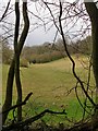
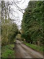
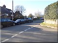
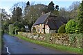
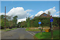
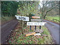
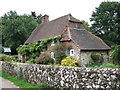
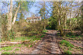
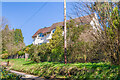
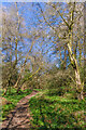
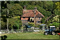
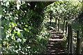
20 photos from this area
Area Information
Key information about the RH5 6RN including its size, population, and administrative classification.
- Area Type
- Postcode
- Area Size
- 9.5 hectares
- Population
- 1997
- Population Density
- 154 people/km²
House Prices in RH5 6RN
15
Properties
£880,042
Average Sold Price
£225,000
Lowest Price
£1,530,000
Highest Price
Showing 15 properties
| Address | Type | Beds | Baths | Last Sale Price | Last Sale Date | |
|---|---|---|---|---|---|---|
| Hurtlands, Sutton Place, Abinger Hammer, RH5 6RN | house | - | - | £1,225,000 | Mar 2021 | |
| Alma Cottage, Sutton Place, Abinger Hammer, RH5 6RN | house | - | - | £1,312,500 | Aug 2020 | |
| Deepdene, Sutton Place, Abinger Hammer, RH5 6RN | Detached | 4 | 1 | £1,520,000 | Jan 2018 | |
| Folly Cottage, Sutton Place, Abinger Hammer, RH5 6RN | house | - | - | £1,530,000 | Nov 2016 | |
| Applegarth, Sutton Place, Abinger Hammer, RH5 6RN | Detached | 4 | 2 | £915,000 | Mar 2014 | |
| Ravenspur, Sutton Place, Abinger Hammer, RH5 6RN | Detached | - | - | £1,000,000 | Jun 2007 | |
| The Drey, Sutton Place, Abinger Hammer, RH5 6RN | Detached | - | - | £725,000 | Aug 2006 | |
| Greenways, Sutton Place, Abinger Hammer, RH5 6RN | Detached | - | - | £225,000 | Oct 2004 | |
| Old Brick Cottage, Sutton Place, Abinger Hammer, RH5 6RN | Detached | - | - | £640,000 | Jun 2004 | |
| Random House, Sutton Place, Abinger Hammer, RH5 6RN | Detached | - | - | £648,000 | Dec 2002 |
Page 1 of 2
Energy Efficiency in RH5 6RN
Amenities
Schools
| Rank | School | Type | Entry gender | Ages |
|---|
Explore more schools in this area
Go to Schools tabDemographics
Household Size
Two person
most common
Accommodation Type
Houses
most common
Tenure
88
majority
Ethnic Group
White
most common
Religion
N/A
most common
Household Composition
N/A
most common
Age
47
median
Adults (30-64 years)
most common
Household Deprivation
N/A
with no deprivation
NS-SEC
53
in Lower managerial occupations
Explore more demographic insights in this area
Go to Demographics tabPlanning
Planning Constraints
- Flood RiskPremium
- Ramsar Wetland SitesPremium
- Area of Outstanding Natural BeautyPremium
- Protected Nature ReservePremium
- Protected WoodlandPremium