Area Overview for RH20 3NA
Photos of RH20 3NA
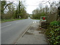
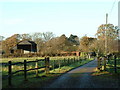


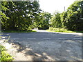
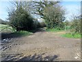
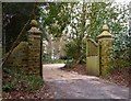
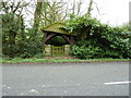
21 photos from this area
Area Information
Key information about the RH20 3NA including its size, population, and administrative classification.
- Area Type
- Postcode
- Area Size
- 6855 m²
- Population
- 1952
- Population Density
- 623 people/km²
House Prices in RH20 3NA
14
Properties
£395,750
Average Sold Price
£170,000
Lowest Price
£675,000
Highest Price
Showing 14 properties
| Address | Type | Beds | Baths | Last Sale Price | Last Sale Date | |
|---|---|---|---|---|---|---|
| Alpen Rose, Storrington Road, Thakeham, RH20 3NA | Detached | 3 | 2 | £675,000 | Mar 2022 | |
| Belmont, Storrington Road, Thakeham, RH20 3NA | Retail | 2 | 1 | £438,000 | Jun 2020 | |
| 1, Crescent House, Storrington Road, Thakeham, RH20 3NA | Semi-detached | 4 | 2 | £300,000 | Jul 2011 | |
| Juniper Cottage, Storrington Road, Thakeham, RH20 3NA | house | - | - | £170,000 | Feb 2001 | |
| Flat 1, The Flower Corner, Storrington Road, Thakeham, RH20 3NA | Maisonette | 2 | 1 | - | - | |
| Little Oak, Storrington Road, Thakeham, RH20 3NA | Bungalow | 3 | 2 | - | - | |
| Ground Floor Flat 3, The Flower Corner, Storrington Road, Thakeham, RH20 3NA | Flat | - | - | - | - | |
| 2, Crescent House, Storrington Road, Thakeham, RH20 3NA | house | - | - | - | - | |
| Cotswold, Storrington Road, Thakeham, RH20 3NA | Bungalow | - | - | - | - | |
| Bethany Cottage, Storrington Road, Thakeham, RH20 3NA | Bungalow | - | - | - | - |
Page 1 of 2
Energy Efficiency in RH20 3NA
Amenities
Schools
| Rank | School | Type | Entry gender | Ages |
|---|
Explore more schools in this area
Go to Schools tabDemographics
Household Size
Two person
most common
Accommodation Type
Houses
most common
Tenure
87
majority
Ethnic Group
White
most common
Religion
N/A
most common
Household Composition
N/A
most common
Age
47
median
Adults (30-64 years)
most common
Household Deprivation
N/A
with no deprivation
NS-SEC
44
in Lower managerial occupations
Explore more demographic insights in this area
Go to Demographics tabPlanning
Planning Constraints
- Flood RiskPremium
- Ramsar Wetland SitesPremium
- Area of Outstanding Natural BeautyPremium
- Protected Nature ReservePremium
- Protected WoodlandPremium