Area Overview for RH2 0BX
Photos of RH2 0BX
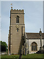
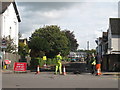
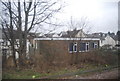
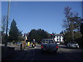
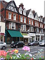
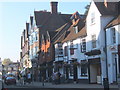
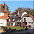
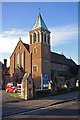
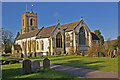
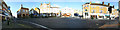
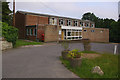
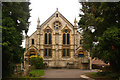
100 photos from this area
Area Information
Key information about the RH2 0BX including its size, population, and administrative classification.
- Area Type
- Postcode
- Area Size
- 1.2 hectares
- Population
- 1910
- Population Density
- 4801 people/km²
House Prices in RH2 0BX
60
Properties
£299,350
Average Sold Price
£140,000
Lowest Price
£505,000
Highest Price
Showing 60 properties
| Address | Type | Beds | Baths | Last Sale Price | Last Sale Date | |
|---|---|---|---|---|---|---|
| 66 Holmesdale Road, Reigate, RH2 0BX | Retail | 3 | 1 | £489,950 | Dec 2022 | |
| 68 Holmesdale Road, Reigate, RH2 0BX | Detached | 4 | 2 | £415,000 | Mar 2022 | |
| 62A Holmesdale Road, Reigate, RH2 0BX | Terraced | 3 | 1 | £445,000 | Nov 2021 | |
| 72A Holmesdale Road, Reigate, RH2 0BX | Maisonette | 1 | 1 | £229,000 | Oct 2021 | |
| 50 Holmesdale Road, Reigate, RH2 0BX | Semi-detached | 3 | 2 | £500,000 | Mar 2021 | |
| 72B Holmesdale Road, Reigate, RH2 0BX | Flat | 2 | 1 | £290,000 | May 2019 | |
| 52 Holmesdale Road, Reigate, RH2 0BX | Semi-detached | 3 | 1 | £505,000 | Dec 2015 | |
| 54 Holmesdale Road, Reigate, RH2 0BX | Maisonette | 2 | 1 | £250,000 | Aug 2014 | |
| 72D Holmesdale Road, Reigate, RH2 0BX | Flat | - | - | £210,000 | Apr 2014 | |
| 58 Holmesdale Road, Reigate, RH2 0BX | Semi-detached | 2 | 1 | £250,000 | Jul 2010 |
Page 1 of 6
Energy Efficiency in RH2 0BX
Amenities
Schools
| Rank | School | Type | Entry gender | Ages |
|---|
Explore more schools in this area
Go to Schools tabDemographics
Household Size
One person
most common
Accommodation Type
Flats
most common
Tenure
60
majority
Ethnic Group
White
most common
Religion
N/A
most common
Household Composition
N/A
most common
Age
47
median
Adults (30-64 years)
most common
Household Deprivation
N/A
with no deprivation
NS-SEC
56
in Lower managerial occupations
Explore more demographic insights in this area
Go to Demographics tabPlanning
Planning Constraints
- Flood RiskPremium
- Ramsar Wetland SitesPremium
- Area of Outstanding Natural BeautyPremium
- Protected Nature ReservePremium
- Protected WoodlandPremium