Area Overview for RH2 0BQ
Photos of RH2 0BQ
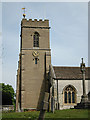
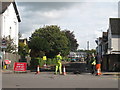
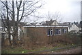
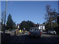
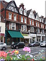
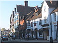
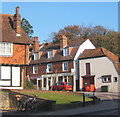
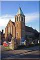
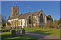
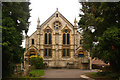
100 photos from this area
Area Information
Key information about the RH2 0BQ including its size, population, and administrative classification.
- Area Type
- Postcode
- Area Size
- 8645 m²
- Population
- 1910
- Population Density
- 4801 people/km²
House Prices in RH2 0BQ
37
Properties
£460,813
Average Sold Price
£156,500
Lowest Price
£782,000
Highest Price
Showing 37 properties
| Address | Type | Beds | Baths | Last Sale Price | Last Sale Date | |
|---|---|---|---|---|---|---|
| 24A Holmesdale Road, Reigate, RH2 0BQ | Flat | 2 | 1 | £156,500 | Aug 2021 | |
| 36 Holmesdale Road, Reigate, RH2 0BQ | Terraced | 2 | 1 | £416,000 | Mar 2021 | |
| 38 Holmesdale Road, Reigate, RH2 0BQ | house | 3 | - | £500,000 | Feb 2021 | |
| 42 Holmesdale Road, Reigate, RH2 0BQ | Detached | 3 | 1 | £480,000 | Jan 2018 | |
| 44 Holmesdale Road, Reigate, RH2 0BQ | Semi-detached | 4 | 1 | £610,000 | Aug 2017 | |
| 46 Holmesdale Road, Reigate, RH2 0BQ | house | - | - | £782,000 | Jul 2015 | |
| 34 Holmesdale Road, Reigate, RH2 0BQ | house | - | - | £242,000 | Aug 2009 | |
| Former, 18 Holmesdale Road, Reigate, RH2 0BQ | undefined | - | - | £500,000 | Sep 2006 | |
| 40A Holmesdale Road, Reigate, RH2 0BQ | Semi-detached | 4 | 3 | - | - | |
| 26B Holmesdale Road, Reigate, RH2 0BQ | Flat | 1 | 1 | - | - |
Page 1 of 4
Energy Efficiency in RH2 0BQ
Amenities
Schools
| Rank | School | Type | Entry gender | Ages |
|---|
Explore more schools in this area
Go to Schools tabDemographics
Household Size
One person
most common
Accommodation Type
Flats
most common
Tenure
60
majority
Ethnic Group
White
most common
Religion
N/A
most common
Household Composition
N/A
most common
Age
47
median
Adults (30-64 years)
most common
Household Deprivation
N/A
with no deprivation
NS-SEC
56
in Lower managerial occupations
Explore more demographic insights in this area
Go to Demographics tabPlanning
Planning Constraints
- Flood RiskPremium
- Ramsar Wetland SitesPremium
- Area of Outstanding Natural BeautyPremium
- Protected Nature ReservePremium
- Protected WoodlandPremium