Area Overview for RH19 4NU
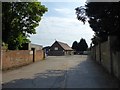
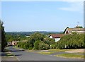
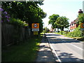
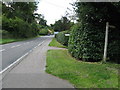
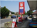
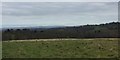
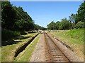
Photos of RH19 4NU


Area Information
Living in RH19 4NU means residing in a small, tightly settled residential cluster defined by a specific postcode. This area encompasses just 902 square metres, creating an intimate environment where residents know their neighbours well. With a population of 2,052 people, the community size is manageable, avoiding the congestion found in larger urban districts while maintaining essential local cohesion. The location sits comfortably within the South East of England and serves as a quiet residential haven outside larger transport hubs. You will find a neighbourhood that prioritises stability over constant change, offering a slower pace of life compared to the busy main roads near Crawley or East Grinstead. Daily life here revolves around local convenience and access to nearby villages. The compact footprint of the postcode ensures that most daily journeys remain short and direct. It is an area that values privacy and space, yet it avoids isolation by maintaining practical links to wider networks. Prospective buyers looking for a stable, low-density environment will find RH19 4NU fits their needs. The area provides a distinct alternative to more developed boroughs, focusing on sustainable living within a defined geographical boundary. You get a straightforward address without the complication of sprawling subdivisions or mixed-use chaoticism. This makes it an attractive option for those seeking a clear, problem-free residential address in a calm setting.
- Area Type
- Postcode
- Area Size
- 902 m²
- Population
- 2052
- Population Density
- 96 people/km²
The property market in RH19 4NU is defined by a predominantly owner-occupied housing stock, with 81 per cent of residents owning their homes. This high ownership rate signals that the neighbourhood attracts buyers looking to settle permanently rather than individuals seeking short-term rentals. The accommodation type is exclusively houses, which removes the choice present in more urban postcodes where flats and terraced property might dominate. You will not find modern converted apartments or purpose-built blocks; instead, the area consists of established residential structures suited to families and those valuing garden space. For buyers considering this small postcode, the market reflects a deliberate choice for traditional living over modern density. The percentage of owner-occupied properties suggests that price fluctuations are often driven by long-term demand rather than speculative investment trends. This stability can be reassuring for those wishing to move into a home they can personally maintain and improve. The absence of rental-heavy blocks means that neighbourhood character remains consistent year on year. When evaluating homes in RH19 4NU, you are looking at average-sized properties that fit the 902 square metre total area, ensuring that no single dwelling overshadows the community feel. The local market operates on a logic of permanence, making it a solid choice for those prioritising a secure tenancy-free future.
House Prices in RH19 4NU
No properties found in this postcode.
Energy Efficiency in RH19 4NU
Living in RH19 4NU offers practical access to a suite of amenities within easy reach. Residents benefit from three key metro locations including Kingscote, Horsted Keynes, and Sheffield Park, making short trips to larger towns feasible. You can easily visit major supermarkets such as Morrisons in Daily Crawley, Co-op in Crawley, and Waitrose in East for your weekly grocery shopping. These retail hubs are just a short journey away, ensuring you do not need to shop locally for all your needs. For those who prefer rail travel, five railway stations are available nearby. East Grinstead Railway Station, Balcombe Railway Station, and Haywards Heath Railway Station provide connections to wider networks. These stations allow you to reach London and other regional destinations without driving. The presence of these transport nodes integrates the quiet residential cluster with the wider commercial and social life of Sussex and Surrey. Daily life involves a balance between the privacy of your home and the convenience of established town centres. Whether you need fresh bread from a local Co-op or a weekend trip to East Grinstead, the necessary infrastructure is all there. This accessibility ensures that the countryside feel does not come at the cost of essential conveniences.
Amenities
Schools
Families living in or considering RH19 4NU have clear options for local education. The nearest primary education is provided by West Hoathly CofE Primary School, which holds an Ofsted rating of satisfactory for primary education. This school serves the core age group for young children before they transition to secondary pathways. For children with special educational needs or those requiring alternative educational settings, Philpots Manor School operates nearby with a good Ofsted rating. The presence of a special school indicates that the local area supports diverse educational requirements beyond the standard curriculum. The mix of schools available suggests a community that values education across different spectrums. You do not find a prevalence of elite private institutions in the immediate vicinity, but rather a range of state-funded options including a church-affiliated primary and a specialist provision. This combination means families have access to both general education and specialised care within a short radius. When researching schools near RH19 4NU, the focus is on practical availability and verified standards rather than prestige rankings. Parents will find that both listed institutions meet regulatory requirements and provide structured learning environments. The proximity of these facilities ensures that daily school runs remain manageable for households in this residential cluster.
| Rank | School | Type | Entry gender | Ages |
|---|
Explore more schools in this area
Go to Schools tabDemographics
The community in RH19 4NU is characterised by established residents with a clear sense of belonging. Eighty-one per cent of households own their homes outright or have a mortgage, indicating a high level of stability within the neighbourhood. This strong ownership figure contrasts with larger rental-heavy estates, suggesting a deep-rooted community fabric. The demographic profile shows a median age of 47 years, reflecting a population dominated by adults aged between 30 and 64. This age range typically represents families in school years, empty nesters, and established professionals who have put down roots. You will find that the housing stock consists almost entirely of houses rather than flats, catering specifically to those seeking ground-level space and gardens. The predominant ethnic group is White, aligning with the broader historical settlement patterns of the South East and surrounding rural towns. With a population density of 96 people per square kilometre, the area feels uncrowded compared to cities like London or Manchester. This density allows for a balanced lifestyle where you retain a private yard without stepping into a concrete jungle. The lack of high-rise blocks or dense terracing reinforces the traditional feel of the settlement. Living here means joining a group of people who value long-term stability over temporary stays.
Household Size
Accommodation Type
Tenure
Ethnic Group
Religion
Household Composition
Age
Household Deprivation
NS-SEC
Explore more demographic insights in this area
Go to Demographics tabPlanning
Planning Constraints
- Flood RiskPremium
- Ramsar Wetland SitesPremium
- Area of Outstanding Natural BeautyPremium
- Protected Nature ReservePremium
- Protected WoodlandPremium