Area Overview for RH19 4AQ
Photos of RH19 4AQ
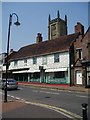
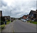
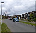
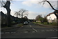
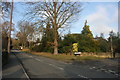
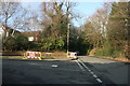
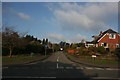
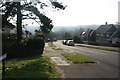
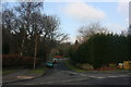


100 photos from this area
Area Information
Key information about the RH19 4AQ including its size, population, and administrative classification.
- Area Type
- Postcode
- Area Size
- 6444 m²
- Population
- 1589
- Population Density
- 902 people/km²
House Prices in RH19 4AQ
29
Properties
£345,822
Average Sold Price
£85,500
Lowest Price
£650,000
Highest Price
Showing 29 properties
| Address | Type | Beds | Baths | Last Sale Price | Last Sale Date | |
|---|---|---|---|---|---|---|
| 79 Dunnings Road, East Grinstead, RH19 4AQ | Semi-detached | 3 | 1 | £438,000 | Aug 2024 | |
| 97 Dunnings Road, East Grinstead, RH19 4AQ | Detached | 3 | 2 | £650,000 | Aug 2024 | |
| 85 Dunnings Road, East Grinstead, RH19 4AQ | Semi-detached | 3 | 2 | £385,000 | Nov 2023 | |
| 101 Dunnings Road, East Grinstead, RH19 4AQ | house | 3 | - | £450,000 | May 2022 | |
| 91 Dunnings Road, East Grinstead, RH19 4AQ | Semi-detached | 3 | - | £425,000 | Mar 2021 | |
| 77 Dunnings Road, East Grinstead, RH19 4AQ | Terraced | 2 | 1 | £340,000 | Dec 2020 | |
| 99 Dunnings Road, East Grinstead, RH19 4AQ | Semi-detached | 2 | 1 | £340,000 | Jan 2018 | |
| 95 Dunnings Road, East Grinstead, RH19 4AQ | Detached | 3 | - | £564,000 | May 2017 | |
| 103 Dunnings Road, East Grinstead, RH19 4AQ | Semi-detached | 2 | - | £320,000 | Oct 2016 | |
| 73 Dunnings Road, East Grinstead, RH19 4AQ | Semi-detached | 3 | - | £351,325 | Sep 2015 |
Page 1 of 3
Energy Efficiency in RH19 4AQ
Amenities
Schools
| Rank | School | Type | Entry gender | Ages |
|---|
Explore more schools in this area
Go to Schools tabDemographics
Household Size
Family (3-5 people)
most common
Accommodation Type
Houses
most common
Tenure
79
majority
Ethnic Group
White
most common
Religion
N/A
most common
Household Composition
N/A
most common
Age
47
median
Adults (30-64 years)
most common
Household Deprivation
N/A
with no deprivation
NS-SEC
36
in Lower managerial occupations
Explore more demographic insights in this area
Go to Demographics tabPlanning
Planning Constraints
- Flood RiskPremium
- Ramsar Wetland SitesPremium
- Area of Outstanding Natural BeautyPremium
- Protected Nature ReservePremium
- Protected WoodlandPremium