Area Overview for RH19 4AF
Photos of RH19 4AF
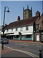
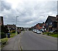
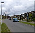
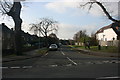
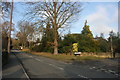
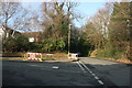
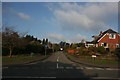
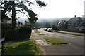


100 photos from this area
Area Information
Key information about the RH19 4AF including its size, population, and administrative classification.
- Area Type
- Postcode
- Area Size
- 1.1 hectares
- Population
- 1589
- Population Density
- 902 people/km²
House Prices in RH19 4AF
28
Properties
£351,356
Average Sold Price
£40,000
Lowest Price
£580,000
Highest Price
Showing 28 properties
| Address | Type | Beds | Baths | Last Sale Price | Last Sale Date | |
|---|---|---|---|---|---|---|
| 23 Morton Road, East Grinstead, RH19 4AF | Semi-detached | 3 | 2 | £440,000 | Oct 2025 | |
| 29 Morton Road, East Grinstead, RH19 4AF | Semi-detached | 4 | 2 | £460,000 | Mar 2025 | |
| 49 Morton Road, East Grinstead, RH19 4AF | Detached | 4 | 2 | £580,000 | Feb 2025 | |
| 5 Morton Road, East Grinstead, RH19 4AF | Semi-detached | 2 | 1 | £400,000 | Jun 2024 | |
| 11 Morton Road, East Grinstead, RH19 4AF | Semi-detached | 3 | 1 | £430,000 | May 2023 | |
| 39 Morton Road, East Grinstead, RH19 4AF | Semi-detached | 3 | 1 | £475,000 | Jan 2023 | |
| 47 Morton Road, East Grinstead, RH19 4AF | house | - | - | £510,000 | Jan 2023 | |
| 19 Morton Road, East Grinstead, RH19 4AF | Semi-detached | 3 | 1 | £425,000 | Nov 2022 | |
| 21 Morton Road, East Grinstead, RH19 4AF | Semi-detached | 3 | - | £418,900 | Jun 2022 | |
| 13 Morton Road, East Grinstead, RH19 4AF | Semi-detached | 3 | 1 | £330,000 | Apr 2021 |
Page 1 of 3
Energy Efficiency in RH19 4AF
Amenities
Schools
| Rank | School | Type | Entry gender | Ages |
|---|
Explore more schools in this area
Go to Schools tabDemographics
Household Size
Family (3-5 people)
most common
Accommodation Type
Houses
most common
Tenure
79
majority
Ethnic Group
White
most common
Religion
N/A
most common
Household Composition
N/A
most common
Age
47
median
Adults (30-64 years)
most common
Household Deprivation
N/A
with no deprivation
NS-SEC
36
in Lower managerial occupations
Explore more demographic insights in this area
Go to Demographics tabPlanning
Planning Constraints
- Flood RiskPremium
- Ramsar Wetland SitesPremium
- Area of Outstanding Natural BeautyPremium
- Protected Nature ReservePremium
- Protected WoodlandPremium