Area Overview for RH19 3ES
Photos of RH19 3ES
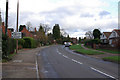
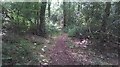
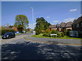
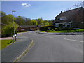
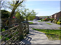
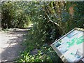
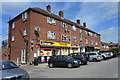
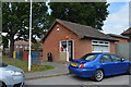

45 photos from this area
Area Information
Key information about the RH19 3ES including its size, population, and administrative classification.
- Area Type
- Postcode
- Area Size
- 1.5 hectares
- Population
- 2228
- Population Density
- 1006 people/km²
House Prices in RH19 3ES
25
Properties
£402,008
Average Sold Price
£180,000
Lowest Price
£650,000
Highest Price
Showing 25 properties
| Address | Type | Beds | Baths | Last Sale Price | Last Sale Date | |
|---|---|---|---|---|---|---|
| 206 Holtye Road, East Grinstead, RH19 3ES | Semi-detached | 5 | 3 | £637,000 | Jul 2025 | |
| 204 Holtye Road, East Grinstead, RH19 3ES | Semi-detached | 4 | 4 | £650,000 | Nov 2023 | |
| 170 Holtye Road, East Grinstead, RH19 3ES | Semi-detached | 4 | 2 | £625,000 | Jun 2022 | |
| 160 Holtye Road, East Grinstead, RH19 3ES | Bungalow | - | - | £540,000 | Sep 2021 | |
| 198 Holtye Road, East Grinstead, RH19 3ES | Bungalow | 3 | 1 | £398,000 | Nov 2019 | |
| 162 Holtye Road, East Grinstead, RH19 3ES | house | 3 | - | £475,000 | May 2019 | |
| 186 Holtye Road, East Grinstead, RH19 3ES | Bungalow | 4 | 2 | £555,000 | Nov 2017 | |
| 194 Holtye Road, East Grinstead, RH19 3ES | Bungalow | 2 | - | £420,000 | Sep 2017 | |
| 180 Holtye Road, East Grinstead, RH19 3ES | Semi-detached | 3 | 2 | £450,000 | Oct 2016 | |
| 176 Holtye Road, East Grinstead, RH19 3ES | Bungalow | 2 | 1 | £335,000 | Jan 2016 |
Page 1 of 3
Energy Efficiency in RH19 3ES
Amenities
Schools
| Rank | School | Type | Entry gender | Ages |
|---|
Explore more schools in this area
Go to Schools tabDemographics
Household Size
Family (3-5 people)
most common
Accommodation Type
Houses
most common
Tenure
88
majority
Ethnic Group
White
most common
Religion
N/A
most common
Household Composition
N/A
most common
Age
47
median
Adults (30-64 years)
most common
Household Deprivation
N/A
with no deprivation
NS-SEC
46
in Lower managerial occupations
Explore more demographic insights in this area
Go to Demographics tabPlanning
Planning Constraints
- Flood RiskPremium
- Ramsar Wetland SitesPremium
- Area of Outstanding Natural BeautyPremium
- Protected Nature ReservePremium
- Protected WoodlandPremium