Area Overview for RH19 2EL
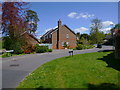
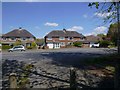
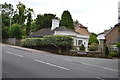
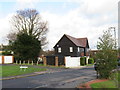
Photos of RH19 2EL


Area Information
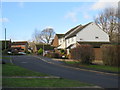
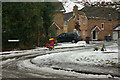
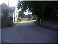
Living in RH19 2EL offers access to a compact residential cluster that spans 1.2 hectares. This specific postcode area accommodates 1,733 residents, creating a relatively tight-knit community where neighbours are often within easy reach. The location lies within the broader East Grinstead postcode district, providing a snapshot of suburban life characterised by its concentrated housing stock and established infrastructure. Residents here benefit from a setting that balances the convenience of nearby services with the relative privacy of a defined neighbourhood. Daily life revolves around a stable population base and a variety of home ownership patterns that define the local character. The area serves as a quiet backdrop to the Rush Common and surrounding developments of East Grinstead. You will find yourself part of a community where house prices reflect local demand for established homes. The small footprint of the postcode means you are likely to know your surroundings well. This environment appeals to those seeking a settled home. The immediate vicinity connects directly to larger transport hubs and retail centres found just beyond the immediate cluster. Your daily routine involves easy access to essential services while maintaining a connection to the wider local network.
- Area Type
- Postcode
- Area Size
- 1.2 hectares
- Population
- 1733
- Population Density
- 4281 people/km²
The housing market in RH19 2EL is firmly rooted in private ownership. With 71 per cent of residents owning their homes, rental demand is lower than in student or commuter hotspots. The accommodation type is overwhelmingly comprised of houses. This indicates that terraced housing, mansions, or blocks of flats are absent from this specific postcode cluster. Buyers entering this market can expect to purchase standalone properties rather than flats. This high ownership rate suggests the area is popular with those who value mortgage repayment over renting. The housing stock is likely to feature older character homes or traditional suburban designs suitable for families. You will not find the volatile price swings associated with high-density rental markets here. Property sellers in RH19 2EL target a specific pool of buyers seeking stability. The limited area size of 1.2 hectares constrains the total number of available homes. This scarcity can drive premiums for well-maintained properties. Overall, the market functions predictably.
House Prices in RH19 2EL
Showing 38 properties
| Address | Type | Beds | Baths | Last Sale Price | Last Sale Date | |
|---|---|---|---|---|---|---|
| 97 Lingfield Road, East Grinstead, RH19 2EL | Semi-detached | 3 | 1 | £417,000 | Aug 2024 | |
| 119 Lingfield Road, East Grinstead, RH19 2EL | Semi-detached | 4 | 2 | £445,000 | Nov 2023 | |
| 103A Lingfield Road, East Grinstead, RH19 2EL | Maisonette | 2 | 2 | £175,000 | Aug 2021 | |
| 99 Lingfield Road, East Grinstead, RH19 2EL | house | - | - | £365,000 | Jun 2021 | |
| 125 Lingfield Road, East Grinstead, RH19 2EL | Semi-detached | 2 | 1 | £317,500 | Dec 2020 | |
| 145 Lingfield Road, East Grinstead, RH19 2EL | Detached | 4 | 2 | £522,000 | Nov 2019 | |
| 129 Lingfield Road, East Grinstead, RH19 2EL | Semi-detached | 2 | - | £315,000 | Jul 2019 | |
| The Wallage, 139 Lingfield Road, East Grinstead, RH19 2EL | Detached | 4 | - | £500,000 | Mar 2017 | |
| 105 Lingfield Road, East Grinstead, RH19 2EL | Semi-detached | 2 | 1 | £325,000 | Jul 2016 | |
| 109 Lingfield Road, East Grinstead, RH19 2EL | house | - | - | £310,000 | Apr 2016 |
Energy Efficiency in RH19 2EL
Your daily routine in RH19 2EL benefits from a network of amenities clustered just outside the postcode boundary. For grocery shopping, three major supermarkets operate within practical reach. You can visit Budgens Lingfield for premium goods, Aldi Dormans for value ranges, or Morrisons Daily for weekly essentials. This variety ensures you do not need to travel far for food and household supplies. Three nearby railway stations provide direct rail links to wider commuter networks. East Grinstead Railway Station serves as the main hub for national rail services. Dormans Railway Station and Lingfield Railway Station offer additional connectivity options for regional travel. You can reach these stations by short car journey or local shuttle links. Kingscote Metro station is another transport node available for extensive railway journeys. These transport links mean commuting to London or surrounding towns requires minimal travel time beyond the local area.
Amenities
Schools
Families residing in RH19 2EL have access to several educational institutions just beyond the immediate postcode boundary. Two primary schools serve the local community with a consistent record of quality. Baldwins Hill Primary School, located in East Grinstead, holds a Good Ofsted rating. Nearby St Mary's CofE Primary School, also in East Grinstead, shares the same Good Ofsted rating. These institutions provide established foundations for early education. For families seeking alternative options, Highfield School operates as an independent institution. While this area lacks a secondary school within the immediate vicinity, the proximity to East Grinstead ensures access to comprehensive colleges. The presence of at least one school with a Good rating for the primary entry category is a standard marker of a family-friendly neighbourhood. The independence of Highfield School caters to parents desiring a private education pathway from an early age. Commuting to these schools involves short travel times from the residential cluster.
| Rank | School | Type | Entry gender | Ages |
|---|
Explore more schools in this area
Go to Schools tabDemographics
The community within RH19 2EL reflects a mature demographic profile with a median age of 47. The majority of residents fall into the adult age range of 30 to 64 years. This indication suggests a neighbourhood dominated by established households rather than young families or elderly retirees. The high home ownership rate of 71 per cent signals a stable population where most people have secured their homes. Accommodation is primarily composed of houses, contrasting with the prevalence of flats in urban centres. Ethnic diversity shows a predominantly White population. This demographic mix contributes to a traditional residential character common in many historic English towns. You are unlikely to encounter significant transient populations or seasonal fluctuations typical of tourist areas. The stable age structure supports consistent demand for family-sized homes or properties suited to mature couples. Low deprivation levels are inferred from the high ownership and stable age profile. Families and individuals looking for security in their housing investment will find this profile reassuring. The demographic consistency fosters a predictable environment for long-term living.
Household Size
Accommodation Type
Tenure
Ethnic Group
Religion
Household Composition
Age
Household Deprivation
NS-SEC
Explore more demographic insights in this area
Go to Demographics tabPlanning
Planning Constraints
- Flood RiskPremium
- Ramsar Wetland SitesPremium
- Area of Outstanding Natural BeautyPremium
- Protected Nature ReservePremium
- Protected WoodlandPremium