Area Overview for RH19 2AH
Photos of RH19 2AH


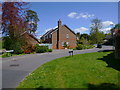
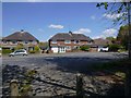
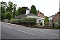
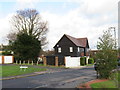
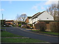


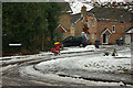
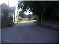
37 photos from this area
Area Information
Key information about the RH19 2AH including its size, population, and administrative classification.
- Area Type
- Postcode
- Area Size
- 1.8 hectares
- Population
- 1809
- Population Density
- 4731 people/km²
House Prices in RH19 2AH
49
Properties
£265,278
Average Sold Price
£138,000
Lowest Price
£415,000
Highest Price
Showing 49 properties
| Address | Type | Beds | Baths | Last Sale Price | Last Sale Date | |
|---|---|---|---|---|---|---|
| 45A Sackville Gardens, East Grinstead, RH19 2AH | Maisonette | 1 | 1 | £190,000 | Aug 2025 | |
| 7 Sackville Gardens, East Grinstead, RH19 2AH | Semi-detached | 2 | 1 | £415,000 | Mar 2025 | |
| 18 Sackville Gardens, East Grinstead, RH19 2AH | Terraced | 3 | 1 | £385,000 | Dec 2024 | |
| 11 Sackville Gardens, East Grinstead, RH19 2AH | Semi-detached | 3 | 1 | £395,000 | Nov 2023 | |
| 44 Sackville Gardens, East Grinstead, RH19 2AH | Semi-detached | 3 | 2 | £405,000 | Jun 2023 | |
| Rainbow Cottage, 47 Sackville Gardens, East Grinstead, RH19 2AH | house | - | - | £385,000 | Oct 2021 | |
| 5 Sackville Gardens, East Grinstead, RH19 2AH | Semi-detached | 3 | 1 | £385,000 | Aug 2021 | |
| 34 Sackville Gardens, East Grinstead, RH19 2AH | Terraced | 2 | 1 | £285,000 | May 2021 | |
| 45 Sackville Gardens, East Grinstead, RH19 2AH | Flat | 1 | 1 | £174,500 | Jan 2021 | |
| 25 Sackville Gardens, East Grinstead, RH19 2AH | house | 3 | 1 | £340,000 | Nov 2020 |
Page 1 of 5
Energy Efficiency in RH19 2AH
Amenities
Schools
| Rank | School | Type | Entry gender | Ages |
|---|
Explore more schools in this area
Go to Schools tabDemographics
Household Size
Family (3-5 people)
most common
Accommodation Type
Houses
most common
Tenure
61
majority
Ethnic Group
White
most common
Religion
N/A
most common
Household Composition
N/A
most common
Age
47
median
Adults (30-64 years)
most common
Household Deprivation
N/A
with no deprivation
NS-SEC
37
in Lower managerial occupations
Explore more demographic insights in this area
Go to Demographics tabPlanning
Planning Constraints
- Flood RiskPremium
- Ramsar Wetland SitesPremium
- Area of Outstanding Natural BeautyPremium
- Protected Nature ReservePremium
- Protected WoodlandPremium