Area Overview for RH18 5BS
Photos of RH18 5BS
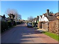
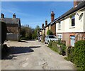
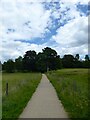
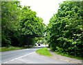
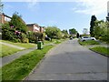
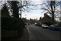
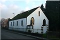
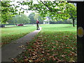
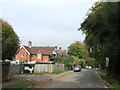
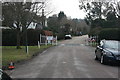
80 photos from this area
Area Information
Key information about the RH18 5BS including its size, population, and administrative classification.
- Area Type
- Postcode
- Area Size
- 1.7 hectares
- Population
- 1656
- Population Density
- 134 people/km²
House Prices in RH18 5BS
19
Properties
£637,094
Average Sold Price
£147,000
Lowest Price
£1,600,000
Highest Price
Showing 19 properties
| Address | Type | Beds | Baths | Last Sale Price | Last Sale Date | |
|---|---|---|---|---|---|---|
| Hill House, Chapel Lane, Forest Row, RH18 5BS | Detached | 6 | 3 | £1,600,000 | Sep 2022 | |
| Ashdown Cottage, Chapel Lane, Forest Row, RH18 5BS | house | - | - | £900,000 | Sep 2021 | |
| Quince Cottage, Chapel Lane, Forest Row, RH18 5BS | house | - | - | £925,000 | Jun 2021 | |
| Ridgeley, Chapel Lane, Forest Row, RH18 5BS | house | - | - | £950,000 | Jun 2021 | |
| Oakhurst, Chapel Lane, Forest Row, RH18 5BS | house | - | - | £1,050,000 | Dec 2020 | |
| Fen Corner, Chapel Lane, Forest Row, RH18 5BS | Detached | 4 | 1 | £507,500 | Jun 2015 | |
| Heronswood, Chapel Lane, Forest Row, RH18 5BS | Detached | 4 | 2 | £530,000 | Jun 2015 | |
| Stowford Lodge, Chapel Lane, Forest Row, RH18 5BS | Semi-detached | 5 | 2 | £720,000 | Feb 2014 | |
| Blue Cedar, Chapel Lane, Forest Row, RH18 5BS | Detached | - | - | £415,000 | Sep 2008 | |
| Beech House, Chapel Lane, Forest Row, RH18 5BS | house | - | - | £735,000 | Aug 2008 |
Page 1 of 2
Energy Efficiency in RH18 5BS
Amenities
Schools
| Rank | School | Type | Entry gender | Ages |
|---|
Explore more schools in this area
Go to Schools tabDemographics
Household Size
Family (3-5 people)
most common
Accommodation Type
Houses
most common
Tenure
78
majority
Ethnic Group
White
most common
Religion
N/A
most common
Household Composition
N/A
most common
Age
47
median
Adults (30-64 years)
most common
Household Deprivation
N/A
with no deprivation
NS-SEC
48
in Lower managerial occupations
Explore more demographic insights in this area
Go to Demographics tabPlanning
Planning Constraints
- Flood RiskPremium
- Ramsar Wetland SitesPremium
- Area of Outstanding Natural BeautyPremium
- Protected Nature ReservePremium
- Protected WoodlandPremium