Area Overview for RH17 6RP
Photos of RH17 6RP
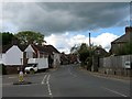
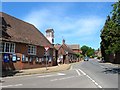
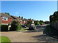
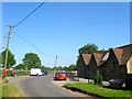
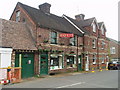
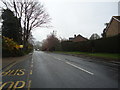
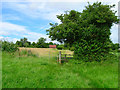
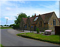
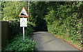
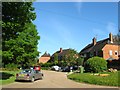
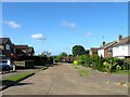
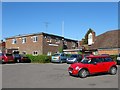
100 photos from this area
Area Information
Key information about the RH17 6RP including its size, population, and administrative classification.
- Area Type
- Postcode
- Area Size
- 9880 m²
- Population
- 1878
- Population Density
- 117 people/km²
House Prices in RH17 6RP
17
Properties
£310,500
Average Sold Price
£165,000
Lowest Price
£492,500
Highest Price
Showing 17 properties
| Address | Type | Beds | Baths | Last Sale Price | Last Sale Date | |
|---|---|---|---|---|---|---|
| 12 Munnion Road, Ardingly, RH17 6RP | house | - | - | £492,500 | Oct 2021 | |
| 8 Munnion Road, Ardingly, RH17 6RP | house | 3 | - | £482,500 | Jun 2021 | |
| 40 Munnion Road, Ardingly, RH17 6RP | house | - | - | £430,000 | Dec 2007 | |
| 2 Munnion Road, Ardingly, RH17 6RP | Detached | 3 | - | £300,000 | Aug 2006 | |
| 6 Munnion Road, Ardingly, RH17 6RP | Detached | 4 | 2 | £297,500 | Jul 2005 | |
| 10 Munnion Road, Ardingly, RH17 6RP | house | - | - | £323,000 | Oct 2004 | |
| Nonsuch, 18 Munnion Road, Ardingly, RH17 6RP | Semi-detached | - | - | £290,000 | Dec 2003 | |
| 52 Munnion Road, Ardingly, RH17 6RP | Detached | 4 | - | £248,000 | May 2002 | |
| 4 Munnion Road, Ardingly, RH17 6RP | Semi-detached | 4 | 2 | £208,000 | Aug 2001 | |
| 42 Munnion Road, Ardingly, RH17 6RP | house | - | - | £179,000 | Nov 1998 |
Page 1 of 2
Energy Efficiency in RH17 6RP
Amenities
Schools
| Rank | School | Type | Entry gender | Ages |
|---|
Explore more schools in this area
Go to Schools tabDemographics
Household Size
Two person
most common
Accommodation Type
Houses
most common
Tenure
71
majority
Ethnic Group
White
most common
Religion
N/A
most common
Household Composition
N/A
most common
Age
47
median
Adults (30-64 years)
most common
Household Deprivation
N/A
with no deprivation
NS-SEC
42
in Lower managerial occupations
Explore more demographic insights in this area
Go to Demographics tabPlanning
Planning Constraints
- Flood RiskPremium
- Ramsar Wetland SitesPremium
- Area of Outstanding Natural BeautyPremium
- Protected Nature ReservePremium
- Protected WoodlandPremium