Area Overview for RH17 5AJ
Photos of RH17 5AJ

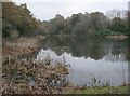
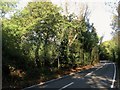
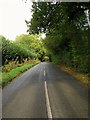

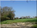
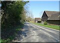
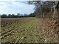
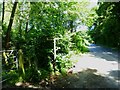
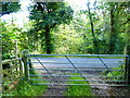
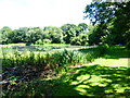

59 photos from this area
Area Information
Key information about the RH17 5AJ including its size, population, and administrative classification.
- Area Type
- Postcode
- Area Size
- 97.1 hectares
- Population
- 1745
- Population Density
- 152 people/km²
House Prices in RH17 5AJ
11
Properties
£1,024,000
Average Sold Price
£250,000
Lowest Price
£1,750,000
Highest Price
Showing 11 properties
| Address | Type | Beds | Baths | Last Sale Price | Last Sale Date | |
|---|---|---|---|---|---|---|
| Bassetts, Cuckfield Road, Ansty, RH17 5AJ | Detached | 3 | 1 | £1,300,000 | Jan 2021 | |
| Lime Grove Barn, Cuckfield Road, Ansty, RH17 5AJ | house | - | - | £745,000 | Apr 2019 | |
| Brew House, Cuckfield Road, Ansty, RH17 5AJ | house | - | - | £1,075,000 | Jun 2018 | |
| Anstye Lodge, Cuckfield Road, Ansty, RH17 5AJ | Detached | 3 | 1 | £250,000 | Aug 2005 | |
| West Riddens, Cuckfield Road, Ansty, RH17 5AJ | Detached | 9 | 6 | £1,750,000 | Mar 2001 | |
| Field Cottage, Cuckfield Road, Ansty, RH17 5AJ | Detached | 5 | 2 | - | - | |
| Anstye Place, Cuckfield Road, Ansty, RH17 5AJ | Detached | 9 | 5 | - | - | |
| Legh Manor, Cuckfield Road, Ansty, RH17 5AJ | Detached | 4 | 3 | - | - | |
| Tennis 60M From West Riddens, Cuckfield Road 64M From Cuckfield Road, Cuckfield Road, Ansty, RH17 5AJ | Leisure | - | - | - | - | |
| Leigh Manor Farmhouse, Cuckfield Road, Ansty, RH17 5AJ | house | - | - | - | - |
Page 1 of 2
Energy Efficiency in RH17 5AJ
Amenities
Schools
| Rank | School | Type | Entry gender | Ages |
|---|
Explore more schools in this area
Go to Schools tabDemographics
Household Size
Family (3-5 people)
most common
Accommodation Type
Houses
most common
Tenure
73
majority
Ethnic Group
White
most common
Religion
N/A
most common
Household Composition
N/A
most common
Age
47
median
Adults (30-64 years)
most common
Household Deprivation
N/A
with no deprivation
NS-SEC
50
in Lower managerial occupations
Explore more demographic insights in this area
Go to Demographics tabPlanning
Planning Constraints
- Flood RiskPremium
- Ramsar Wetland SitesPremium
- Area of Outstanding Natural BeautyPremium
- Protected Nature ReservePremium
- Protected WoodlandPremium