Area Overview for RH15 9QW
Photos of RH15 9QW
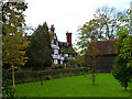
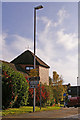
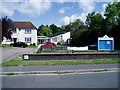
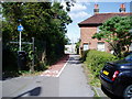
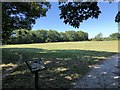
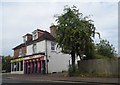
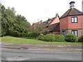
38 photos from this area
Area Information
Key information about the RH15 9QW including its size, population, and administrative classification.
- Area Type
- Postcode
- Area Size
- 1.7 hectares
- Population
- 1651
- Population Density
- 3007 people/km²
House Prices in RH15 9QW
32
Properties
£280,011
Average Sold Price
£66,200
Lowest Price
£525,000
Highest Price
Showing 32 properties
| Address | Type | Beds | Baths | Last Sale Price | Last Sale Date | |
|---|---|---|---|---|---|---|
| 7 Hammonds Ridge, Burgess Hill, RH15 9QW | Detached | 3 | 2 | £511,000 | Jul 2025 | |
| 71 Hammonds Ridge, Burgess Hill, RH15 9QW | Terraced | 2 | 1 | £305,000 | Jun 2023 | |
| 59 Hammonds Ridge, Burgess Hill, RH15 9QW | Detached | - | - | £320,000 | Jun 2022 | |
| 57 Hammonds Ridge, Burgess Hill, RH15 9QW | house | 4 | 2 | £495,000 | Feb 2021 | |
| 73 Hammonds Ridge, Burgess Hill, RH15 9QW | house | 2 | 1 | £293,250 | Feb 2021 | |
| 63 Hammonds Ridge, Burgess Hill, RH15 9QW | Detached | 3 | 2 | £440,000 | Oct 2020 | |
| 69 Hammonds Ridge, Burgess Hill, RH15 9QW | house | - | - | £425,000 | Sep 2018 | |
| 37 Hammonds Ridge, Burgess Hill, RH15 9QW | house | - | - | £525,000 | May 2017 | |
| 31 Hammonds Ridge, Burgess Hill, RH15 9QW | Semi-detached | 3 | 2 | £398,000 | Feb 2015 | |
| 67 Hammonds Ridge, Burgess Hill, RH15 9QW | Detached | 4 | - | £400,000 | Nov 2014 |
Page 1 of 4
Energy Efficiency in RH15 9QW
Amenities
Schools
| Rank | School | Type | Entry gender | Ages |
|---|
Explore more schools in this area
Go to Schools tabDemographics
Household Size
Family (3-5 people)
most common
Accommodation Type
Houses
most common
Tenure
84
majority
Ethnic Group
White
most common
Religion
N/A
most common
Household Composition
N/A
most common
Age
47
median
Adults (30-64 years)
most common
Household Deprivation
N/A
with no deprivation
NS-SEC
47
in Lower managerial occupations
Explore more demographic insights in this area
Go to Demographics tabPlanning
Planning Constraints
- Flood RiskPremium
- Ramsar Wetland SitesPremium
- Area of Outstanding Natural BeautyPremium
- Protected Nature ReservePremium
- Protected WoodlandPremium