Area Overview for RH15 8EH
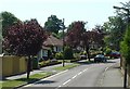
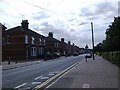
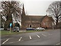
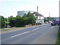
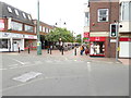
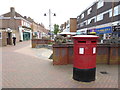
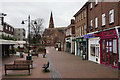
Photos of RH15 8EH

Area Information
RH15 8EH is a specific postcode area covering a small residential cluster of just 2.3 hectares. This compact footprint supports a population of 1770 people, creating a tight-knit environment where neighbours are likely to know one another. You will find this area situated within England, offering a distinct feel from wider suburban sprawl due to its limited size. The community feels intimate, lacking the anonymity of larger boroughs while maintaining essential residential services. For those considering moving to this location, the scale of the neighbourhood ensures that daily life remains manageable and accessible. Living in RH15 8EH means navigating a space designed for density without excessive scale. The concentration of residents on such a small land area suggests a high level of interaction within the street. This postcode serves as a focal point for a defined residential experience rather than a sprawling district. You can expect a setup where every house is potentially visible from another, fostering a sense of immediate community oversight. The area functions as a complete living unit in itself, integrating housing with proximity to key local services. It is a place defined by its boundaries and its people. Homes in RH15 8EH cater to a settled population, with the demographic profile indicating a mature community. The restriction of the area to 2.3 hectares means that infrastructure is fixed and well-established. There is no ambiguity about the scope of this neighbourhood; it is a precise, defined slice of Burgess Hill designed for people seeking stability. The environment supports a routine of localised living without the need to travel far for basic requirements. This makes it an attractive option for buyers who value a quiet, contained lifestyle over extensive urban development.
- Area Type
- Postcode
- Area Size
- 2.3 hectares
- Population
- 1770
- Population Density
- 3349 people/km²
The property market in RH15 8EH is defined by a substantial owner-occupier base. With 61% of residents owning their homes, this postcode operates more like a settled residential zone than a high-turnover rental hotspot. Houses form the primary accommodation type, meaning you will not find large blocks of flats or purpose-built rental schemes dominating the streets. Buying or selling a home here involves engaging with homeowners who have a vested interest in the locality. This dynamic can make the market more predictable for buyers seeking a long-term investment. For those looking at homes in RH15 8EH, the focus is on single-family dwellings. The dominance of houses aligns with the demographic reality of a median age of 47. Families and older professionals typically prefer the security of ownership in smaller, established clusters. The high ownership percentage suggests that existing residents are active in the property market, selling up or moving to need rather than leaving due to market pressure. This creates a steady stream of inventory for buyers to choose from. The small size of the area, covering only 2.3 hectares, limits the sheer volume of available properties compared to larger neighbours. However, this scarcity often drives value and interest. Every property listed is significant within the local context. Potential buyers should expect competition for suitable houses, particularly those that fit the preferences of the dominant household types. The market reflects the practical needs of a community that prioritises living space and stability. Understanding this balance between supply and demand in a compact area is key for anyone entering the transaction process in RH15 8EH.
House Prices in RH15 8EH
Showing 37 properties
| Address | Type | Beds | Baths | Last Sale Price | Last Sale Date | |
|---|---|---|---|---|---|---|
| 29 Crescent Road, Burgess Hill, RH15 8EH | Semi-detached | 3 | 2 | £650,000 | Sep 2023 | |
| 19 Crescent Road, Burgess Hill, RH15 8EH | Detached | 3 | 1 | £960,000 | Jun 2021 | |
| 49 Crescent Road, Burgess Hill, RH15 8EH | house | - | - | £625,000 | Jul 2017 | |
| 51 Crescent Road, Burgess Hill, RH15 8EH | house | - | - | £530,000 | May 2017 | |
| 39 Crescent Road, Burgess Hill, RH15 8EH | house | - | - | £497,500 | Jun 2015 | |
| 27 Crescent Road, Burgess Hill, RH15 8EH | house | - | - | £980,000 | Feb 2015 | |
| 53 Crescent Road, Burgess Hill, RH15 8EH | house | 4 | 2 | £742,500 | Dec 2014 | |
| 33 Crescent Road, Burgess Hill, RH15 8EH | Semi-detached | 3 | 1 | £345,000 | Sep 2014 | |
| 37 Crescent Road, Burgess Hill, RH15 8EH | house | 4 | 3 | £600,000 | Jul 2013 | |
| 43 Crescent Road, Burgess Hill, RH15 8EH | Semi-detached | - | - | £395,000 | Dec 2005 |
Energy Efficiency in RH15 8EH
Residents of RH15 8EH enjoy immediate access to essential amenities within practical reach. Retail options include Iceland Church, Waitrose Burgess, and The Southern Co-operative Co-op. These five notable shops provide everything from grocery necessities to household goods without the need for long drives. Having Waitrose nearby ensures high-quality shopping opportunities right in your local sphere. The Supermarket proximity supports a self-sufficient daily routine where most food shopping can be completed locally. Transport links are well-developed for the small size of the neighbourhood. Five railway stations lie within reach, including Burgess Hill Railway Station, Wivelsfield Railway Station, and Hassocks Railway Station. This rail connectivity offers vital escapability for commuters and visitors alike. Sheffield Park Metro station is also accessible, further expanding the transport network. The availability of multiple rail options means you are never isolated from the wider network. It is incredibly convenient to have frequent train services so close to your home. For leisure, the area supports an active lifestyle with nearby recreational facilities. While specific parks are not listed in the immediate amenity count, the presence of a Metro station at Sheffield Park hints at connected leisure zones. Shops like The Southern Co-operative Co-op may contribute to the local social scene alongside other retail ventures. These facilities create a neighbourhood where you can manage daily tasks without visiting distant city centres. The blend of shopping, rail access, and nearby hubs makes living in RH15 8EH comfortable. You have the infrastructure to support a balanced life involving work, shopping, and leisure activities.
Amenities
Schools
Families moving to RH15 8EH have access to a selection of educational institutions nearby. The Burgess Hill area offers schools ranging from primary to special needs provision, meeting various educational requirements. St Wilfrid's Catholic Primary School in Burgess Hill is a notable option for early years education. Parents can also choose Oakmeeds Community College, another primary school, for younger children. For children requiring special needs support, Woodlands Meed serves the local community with specialised provision. The local education landscape extends to secondary options, with The Burgess Hill Academy holding a good Ofsted rating. This academy stands out as a key institution for older students in the region. The mix of school types ensures that parents have choices that align with specific educational philosophies and needs. You can select from Catholic faith schools or community-based academies depending on your preferences. The presence of a special school nearby indicates a comprehensive approach to local education infrastructure. When considering schools near RH15 8EH, you can see a blend of traditional and modern provision. The proximity of these institutions to the postcode reduces commute times for pupils. St Wilfrid's Catholic Primary School appears twice in records, suggesting strong community presence or multiple branches of the same institution. The good rating of The Burgess Hill Academy provides a clear signal of quality for secondary education. This variety means that the area supports a full educational journey from primary years through to secondary transition. Families often cite proximity to these well-regarded institutions as a primary factor when choosing homes in this Blackwood Road area.
| Rank | School | Type | Entry gender | Ages |
|---|
Explore more schools in this area
Go to Schools tabDemographics
The community in RH15 8EH is characterised by a mature population, with a median age standing at 47 years. Adults between the ages of 30 and 64 represent the most common age range, confirming that families and established professionals form the core of the resident base. This age profile suggests an area where children are present but the largest group consists of working-age adults and retirees. You will find that a significant portion of the population has already made their home here, driven by the high rate of home ownership. Sixty-one per cent of residents own their homes outright or with a mortgage, indicating a settled community rather than a transient rental sector. This high level of ownership usually translates to families who are invested in their local environment. Houses remain the predominant accommodation type, reinforcing the residential character of this small postcode. The demographic data points to a diverse yet stable society, with White residents forming the predominant ethnic group. This reflects a traditional English suburban demographic structure. Living in this area, you join a crowd that values stability. The concentration of older adults alongside young families creates a balanced neighbourhood dynamic. There is little evidence of rapid turnover or temporary housing. The home ownership figure of 61% is a concrete indicator that many people consider this their long-term base. This stability often brings benefits regarding local funding and community cohesion. The area attracts buyers who want to put down roots rather than look for a quick move. Your neighbours are likely to have lived in similar properties for years, sharing the history of the local streets.
Household Size
Accommodation Type
Tenure
Ethnic Group
Religion
Household Composition
Age
Household Deprivation
NS-SEC
Explore more demographic insights in this area
Go to Demographics tabPlanning
Planning Constraints
- Flood RiskPremium
- Ramsar Wetland SitesPremium
- Area of Outstanding Natural BeautyPremium
- Protected Nature ReservePremium
- Protected WoodlandPremium