Area Overview for RH15 0PH
Photos of RH15 0PH
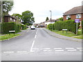
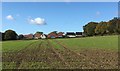
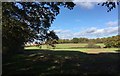
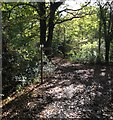
37 photos from this area
Area Information
Key information about the RH15 0PH including its size, population, and administrative classification.
- Area Type
- Postcode
- Area Size
- 1.9 hectares
- Population
- 1568
- Population Density
- 5598 people/km²
House Prices in RH15 0PH
48
Properties
£262,175
Average Sold Price
£64,000
Lowest Price
£425,000
Highest Price
Showing 48 properties
| Address | Type | Beds | Baths | Last Sale Price | Last Sale Date | |
|---|---|---|---|---|---|---|
| 48 St Andrews Road, Burgess Hill, RH15 0PH | Semi-detached | 4 | 1 | £400,000 | Sep 2025 | |
| 80 St Andrews Road, Burgess Hill, RH15 0PH | Terraced | 3 | 1 | £350,000 | Dec 2023 | |
| 72 St Andrews Road, Burgess Hill, RH15 0PH | Semi-detached | 2 | 1 | £345,000 | Apr 2023 | |
| 96 St Andrews Road, Burgess Hill, RH15 0PH | house | - | - | £425,000 | Jul 2022 | |
| 120 St Andrews Road, Burgess Hill, RH15 0PH | house | - | - | £359,950 | Mar 2021 | |
| 76 St Andrews Road, Burgess Hill, RH15 0PH | Terraced | 3 | 1 | £260,000 | Jan 2020 | |
| 32 St Andrews Road, Burgess Hill, RH15 0PH | Terraced | 2 | - | £315,000 | Jan 2020 | |
| 30 St Andrews Road, Burgess Hill, RH15 0PH | Semi-detached | 2 | 1 | £282,000 | May 2018 | |
| 92 St Andrews Road, Burgess Hill, RH15 0PH | Semi-detached | 2 | 1 | £187,000 | Apr 2007 | |
| 104 St Andrews Road, Burgess Hill, RH15 0PH | Terraced | - | - | £79,950 | Aug 1999 |
Page 1 of 5
Energy Efficiency in RH15 0PH
Amenities
Schools
| Rank | School | Type | Entry gender | Ages |
|---|
Explore more schools in this area
Go to Schools tabDemographics
Household Size
Two person
most common
Accommodation Type
Houses
most common
Tenure
79
majority
Ethnic Group
White
most common
Religion
N/A
most common
Household Composition
N/A
most common
Age
47
median
Adults (30-64 years)
most common
Household Deprivation
N/A
with no deprivation
NS-SEC
38
in Lower managerial occupations
Explore more demographic insights in this area
Go to Demographics tabPlanning
Planning Constraints
- Flood RiskPremium
- Ramsar Wetland SitesPremium
- Area of Outstanding Natural BeautyPremium
- Protected Nature ReservePremium
- Protected WoodlandPremium