Area Overview for RH14 9TB
Photos of RH14 9TB
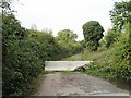
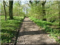
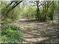
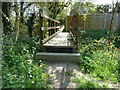
22 photos from this area
Area Information
Key information about the RH14 9TB including its size, population, and administrative classification.
- Area Type
- Postcode
- Area Size
- 1.3 hectares
- Population
- 1405
- Population Density
- 2011 people/km²
House Prices in RH14 9TB
16
Properties
£250,750
Average Sold Price
£71,000
Lowest Price
£360,000
Highest Price
Showing 16 properties
| Address | Type | Beds | Baths | Last Sale Price | Last Sale Date | |
|---|---|---|---|---|---|---|
| 15 Woodlands Way, Billingshurst, RH14 9TB | Bungalow | 3 | - | £360,000 | Oct 2023 | |
| 13 Woodlands Way, Billingshurst, RH14 9TB | Semi-detached | 2 | - | £345,000 | Sep 2017 | |
| 5 Woodlands Way, Billingshurst, RH14 9TB | Semi-detached | - | - | £280,000 | Jun 2016 | |
| 4 Woodlands Way, Billingshurst, RH14 9TB | Bungalow | - | - | £285,000 | Jun 2015 | |
| 7 Woodlands Way, Billingshurst, RH14 9TB | Bungalow | - | - | £230,000 | Apr 2014 | |
| 11 Woodlands Way, Billingshurst, RH14 9TB | Semi-detached | - | - | £310,000 | May 2008 | |
| 6 Woodlands Way, Billingshurst, RH14 9TB | Semi-detached | - | - | £243,500 | Oct 2007 | |
| 1 Woodlands Way, Billingshurst, RH14 9TB | Semi-detached | 3 | 1 | £238,000 | Jul 2006 | |
| 14 Woodlands Way, Billingshurst, RH14 9TB | Semi-detached | - | - | £145,000 | Apr 2002 | |
| 3 Woodlands Way, Billingshurst, RH14 9TB | Semi-detached | - | - | £71,000 | Jan 1995 |
Page 1 of 2
Energy Efficiency in RH14 9TB
Amenities
Schools
| Rank | School | Type | Entry gender | Ages |
|---|
Explore more schools in this area
Go to Schools tabDemographics
Household Size
Two person
most common
Accommodation Type
Houses
most common
Tenure
77
majority
Ethnic Group
White
most common
Religion
N/A
most common
Household Composition
N/A
most common
Age
47
median
Adults (30-64 years)
most common
Household Deprivation
N/A
with no deprivation
NS-SEC
44
in Lower managerial occupations
Explore more demographic insights in this area
Go to Demographics tabPlanning
Planning Constraints
- Flood RiskPremium
- Ramsar Wetland SitesPremium
- Area of Outstanding Natural BeautyPremium
- Protected Nature ReservePremium
- Protected WoodlandPremium