Area Overview for RH14 0LX
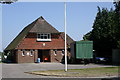
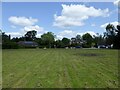
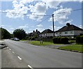
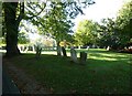
Photos of RH14 0LX

Area Information
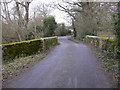
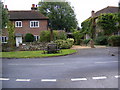
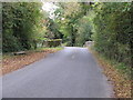
Living in the RH14 0LX postcode offers a quiet residential life within a compact cluster. This specific area covers just 1.9 hectares yet supports a population of 1263 residents. You will find a community character defined by its small scale and low density, with approximately 45 people per square kilometre. The environment feels intimate, contrasting with the broader densities often found in suburban areas. Daily life here revolves around a peaceful neighbourhood setting where space is abundant relative to the number of houses. The area functions as a settled residential pocket, likely surrounded by greenery which minimises noise and visual clutter from neighbouring developments. You are not looking at a town centre or a high-density housing estate, but rather a contained district of homes designed for those seeking calm. The population figure indicates a stable community rather than a rapidly growing or shrinking locality. This makes RH14 0LX suitable for buyers who prioritise seclusion and low traffic volumes over immediate access to urban amenities. The very specific nature of the postcode suggests a neighbourhood with clear boundaries, offering residents a strong sense of locality without the chaos of larger settlements.
- Area Type
- Postcode
- Area Size
- 1.9 hectares
- Population
- 1263
- Population Density
- 45 people/km²
The property market in RH14 0LX is defined by a strong preference for owner-occupied housing. With home ownership standing at 69%, the area attracts buyers looking to settle rather than those seeking short-term rentals. Houses dominate the accommodation type data, meaning you will not encounter modern apartment blocks or purpose-built flats typical of urban zones. This housing stock reflects established neighbourhoods where character-built homes are the norm. For buyers searching for homes in RH14 0LX, the environment suggests opportunities for family homes or properties suitable for couples without school-aged children. The high ownership rate indicates a market driven by long-term residents who have chosen this area for its permanence. Renters will find fewer options available compared to cities with high transient populations. The composition of the housing stock limits investment opportunities to traditional property types, which often hold value well in rural-adjacent counties. Purchasing here means joining a community where properties are treated as family assets rather than investment vehicles. This stability creates a predictable market less prone to rapid turnover, although specific price figures are not included in the current overview.
House Prices in RH14 0LX
Showing 13 properties
| Address | Type | Beds | Baths | Last Sale Price | Last Sale Date | |
|---|---|---|---|---|---|---|
| Pippins, Village Road, Kirdford, RH14 0LX | Bungalow | 2 | 1 | £550,000 | Aug 2025 | |
| Mayflower Cottage, Village Road, Kirdford, RH14 0LX | house | - | - | £750,000 | Sep 2022 | |
| Irelands House, Village Road, Kirdford, RH14 0LX | Semi-detached | 4 | 1 | £675,000 | Jul 2018 | |
| Woodlea, Village Road, Kirdford, RH14 0LX | Bungalow | 4 | - | £465,000 | Jun 2015 | |
| Cobblers, Village Road, Kirdford, RH14 0LX | house | - | - | £626,000 | Jun 2010 | |
| Orchard Cottage, Village Road, Kirdford, RH14 0LX | Semi-detached | 3 | 2 | £392,500 | Jun 2008 | |
| Ferrers, Village Road, Kirdford, RH14 0LX | Bungalow | - | - | £335,000 | Nov 2006 | |
| Corrib, Village Road, Kirdford, RH14 0LX | Detached | - | - | £285,000 | Sep 2003 | |
| Ellington, Village Road, Kirdford, RH14 0LX | Detached | - | - | £235,000 | Feb 2001 | |
| Hannahs Cottage, Village Road, Kirdford, RH14 0LX | Detached | 3 | 2 | - | - |
Energy Efficiency in RH14 0LX
Your daily lifestyle in RH14 0LX revolves around a mix of local convenience and nearby rural amenities. Retail options include five notable shopping points, featuring Co-op EGMF Billingshurst – A272, Co-op Petworth, and Sainsburys Billinghurst. You can access essential groceries and everyday household goods without extensive travel, though you must choose between these three specific locations based on your route preferences. Public transport remains a key feature of your daily routine, with two railway stations listed as within practical reach. Billingshurst Railway Station and Pulborough Railway Station offer regular services connecting the area to Brighton, London, and Hampshire. These stations are vital for commuters who value rail reliability over driving. For leisure and dining, the retail category of amenities suggests a focus on essential provisioning rather than a dedicated entertainment district. You will find no dedicated leisure centres, parks, or cinemas listed in the immediate proximity data. Your lifestyle will likely involve car dependency for access to cultural activities or larger retail parks beyond the immediate three Co-op and Sainsbury's outlets.
Amenities
Schools
Education provision for families in RH14 0LX is anchored by Kirdford Junior School. This primary school serves as the key educational institution within practical reach of new residents. The Omshiven data lists this as a primary school, indicating it covers the foundation stages of a child's education. As a junior school, it specifically caters to children in the later years of primary education, taking pupils once they have completed infant school. This means you will need to consider transport or proximity to infant schools for younger children, as the data does not list a nearby infant school or secondary institution. The presence of only one school type in the immediate vicinity suggests that older children may need to travel to Pulborough or Billingshurst for secondary education. Parents considering living in RH14 0LX must factor in whether Kirdford Junior School meets their specific curriculum or religious requirements. The concentration of one named primary school highlights a need for families to plan carefully regarding all key stages of their children's education if they choose this postcode.
| Rank | School | Type | Entry gender | Ages |
|---|
Explore more schools in this area
Go to Schools tabDemographics
The community in RH14 0LX reflects a mature demographic profile suitable for established households. You will find that adults aged between 30 and 64 years represent the most common age range, anchoring the area's social fabric. The median age of 47 years indicates a population heavily skewed towards middle age and beyond, suggesting families are often in later stages of raising children or enjoying a more settled phase of life. Ownership remains central to this community, with 69% of households owned outright or with a mortgage. This high level of home ownership typically translates to greater investment in property maintenance and local stability. Houses form the dominant accommodation type, reinforcing the suburban nature of the living environment rather than tall blocks or flats. The predominant ethnic group is White, mirroring the traditional demographic of many parts of West Sussex. This homogeneity often correlates with a cohesive community spirit where neighbours know each other by name. The age structure implies that schools near RH14 0LX cater primarily to younger children and adolescents, rather than serving a full range of educational needs from infants to teenagers.
Household Size
Accommodation Type
Tenure
Ethnic Group
Religion
Household Composition
Age
Household Deprivation
NS-SEC
Explore more demographic insights in this area
Go to Demographics tabPlanning
Planning Constraints
- Flood RiskPremium
- Ramsar Wetland SitesPremium
- Area of Outstanding Natural BeautyPremium
- Protected Nature ReservePremium
- Protected WoodlandPremium