Area Overview for RH13 8RA
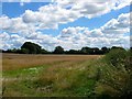
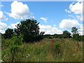
Photos of RH13 8RA


Area Information
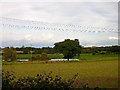
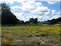
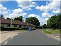
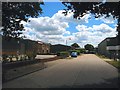
Living in RH13 8RA offers a distinct residential experience defined by its modest scale and established character. This specific postcode covers a small residential cluster spanning just 21.0 hectares, creating an intimate setting where neighbours know one another. The area supports a population of 1,228 people, which contributes to a measured population density of 94 people per square kilometre. This low-density environment suggests a quiet, suburban lifestyle far removed from urban congestion. Residents here enjoy a sense of space and tranquility that larger settlements often lack. The configuration of the land supports a close-knit community atmosphere while maintaining individual privacy for each household. Daily life in this location revolves around a self-sufficient neighbourhood model where essential services are accessible within practical reach. The relatively small footprint means that travel times to nearby amenities are generally short. You will find that the area balances rural relaxation with reasonable access to commercial facilities. The layout supports a pace of living that many families and individuals find appealing. This postcode represents a specific slice of the local housing market, catering to those who prioritise peace of mind over high-rise urban convenience. The geography supports a stable, established community where the built environment has settled into a quiet, predictable rhythm.
- Area Type
- Postcode
- Area Size
- 21.0 hectares
- Population
- 1228
- Population Density
- 94 people/km²
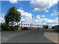
The property market in RH13 8RA is overwhelmingly characterised by owner-occupation, with 86% of households having purchased their homes. This statistic indicates a low level of rental turnover and a market driven by long-term investment rather than short-term tenancies. Consequently, buyers looking for homes in this specific postcode should expect to join a community of established owners. The dominance of houses as the main accommodation type means that the streets are lined with detached or semi-detached properties rather than apartment blocks. This housing pattern appeals to families seeking privacy and outdoor space, as well as mature buyers looking to downsize from larger urban homes. The concentration of homeownership suggests that price volatility may be lower than in areas dominated by private landlords. Sellers in this market typically stay put for extended periods, which can lead to longer listing times for available properties. When searching for properties, you will find a stock that has been passed down through generations or accumulated over many decades of market activity. This stability often translates into well-maintained buildings and mature gardens that define the area's aesthetic. The market here rewards patience and thorough research, as demand is usually steady but not frantic. Potential buyers should focus on the condition of individual properties, as the value of these homes relies heavily on their specific upkeep and location within the cluster.
House Prices in RH13 8RA
Showing 6 properties
| Address | Type | Beds | Baths | Last Sale Price | Last Sale Date | |
|---|---|---|---|---|---|---|
| Cvrm, Unit 7, Star Road, Partridge Green, RH13 8RA | Industrial | - | - | - | - | |
| Heritage Travel, Unit 7, Star Road, Partridge Green, RH13 8RA | Office | - | - | - | - | |
| Brightstone Construction Limited, Star Road, Partridge Green, RH13 8RA | warehouse | - | - | - | - | |
| Neils Steel Ltd, Unit 19, Star Road Trading Estate, Star Road, Partridge Green, RH13 8RA | general_industrial | - | - | - | - | |
| Transeal Ltd, Unit 4A, Star Road, Partridge Green, RH13 8RA | Industrial | - | - | - | - | |
| Unit 21, Star Road, Partridge Green, RH13 8RA | Industrial | - | - | - | - |
Energy Efficiency in RH13 8RA
Your daily lifestyle in RH13 8RA centers on a cluster of essential retail outlets within practical reach. You will find five main retail venues operating nearby, providing necessary goods without requiring a long journey into town. Sainsburys in Henfield stands out as a major destination for your weekly grocery shopping needs, offering a comprehensive range of products. For more convenient, everyday purchases, you can visit the Co-op Partridge and the Co-op in Cowfold. These locations ensure that you rarely need to exceed a short drive to stock your pantry or replace household items. This retail corridor supports a self-sufficient lifestyle where your morning coffee or evening meal does not depend on a lengthy commute. The specific inclusion of Co-op Partridge suggests a defensible small village feel where a traditional shopkeeper might operate. Dining options are limited to these high streets, meaning restaurants are found in Henfield or Cowfold rather than immediately adjacent to your postcode. You will appreciate the balance between having nearby essentials and the convenience of living near larger shopping villages. This arrangement reduces domestic congestion while maintaining access to quality food supplies. The layout encourages short trips for routine needs, making errands manageable for all family members regardless of age or mobility.
Amenities
Schools
| Rank | School | Type | Entry gender | Ages |
|---|
Explore more schools in this area
Go to Schools tabDemographics
The community in RH13 8RA reflects a mature demographic profile with a median age of 47 years. Most residents fall into the 30 to 64 age range, indicating that this area attracts families and professionals well into middle age. This age distribution suggests proximity to schools and transport links that serve commuters, yet the dominant population prefers the stability of established homeownership. Homeownership stands at an impressive 86%, meaning that the vast majority of residents have purchased their properties rather than renting. This high ownership rate typically correlates with long-term residents who have invested in their local surroundings over decades. Houses remain the predominant accommodation type in this postcode, reinforcing the family-oriented nature of the settlement. The housing stock consists primarily of single-family dwellings rather than flats or high-density blocks. The predominant ethnic group is White, mirroring national trends but reflecting the specific social fabric of this rural English locality. There is little recent migration or transient population, creating a consistent neighbourhood where children have known their neighbours since early childhood. This demographic stability fosters a secure environment where community bonds are strong and informal networks operate effectively.
Household Size
Accommodation Type
Tenure
Ethnic Group
Religion
Household Composition
Age
Household Deprivation
NS-SEC
Explore more demographic insights in this area
Go to Demographics tabPlanning
Planning Constraints
- Flood RiskPremium
- Ramsar Wetland SitesPremium
- Area of Outstanding Natural BeautyPremium
- Protected Nature ReservePremium
- Protected WoodlandPremium