Area Overview for RH13 8JS
Photos of RH13 8JS
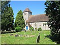
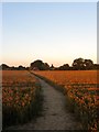
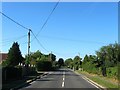

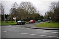
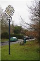
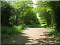
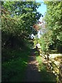
100 photos from this area
Area Information
Key information about the RH13 8JS including its size, population, and administrative classification.
- Area Type
- Postcode
- Area Size
- 7.2 hectares
- Population
- 1324
- Population Density
- 420 people/km²
House Prices in RH13 8JS
28
Properties
£424,607
Average Sold Price
£144,500
Lowest Price
£802,500
Highest Price
Showing 28 properties
| Address | Type | Beds | Baths | Last Sale Price | Last Sale Date | |
|---|---|---|---|---|---|---|
| Lynmede, Church Road, Partridge Green, RH13 8JS | Semi-detached | 4 | 1 | £719,000 | Jan 2025 | |
| Hookshile, Church Road, Partridge Green, RH13 8JS | house | - | - | £802,500 | Nov 2017 | |
| Hillview, Church Road, Partridge Green, RH13 8JS | house | - | - | £540,000 | Dec 2014 | |
| Badgers Ash, Church Road, Partridge Green, RH13 8JS | house | - | - | £530,000 | Jun 2014 | |
| Little Orchard, Church Road, Partridge Green, RH13 8JS | house | - | - | £490,000 | Feb 2014 | |
| Kingsdown, Church Road, Partridge Green, RH13 8JS | Semi-detached | 3 | - | £303,000 | Nov 2012 | |
| South Winds, Church Road, Partridge Green, RH13 8JS | Detached | - | - | £428,000 | Jul 2008 | |
| Rainbows End, Church Road, Partridge Green, RH13 8JS | Semi-detached | - | - | £290,000 | Jul 2007 | |
| The Rosary, Church Road, Partridge Green, RH13 8JS | house | 4 | 1 | £455,000 | Apr 2006 | |
| Dormers, Church Road, Partridge Green, RH13 8JS | Detached | 4 | 1 | £245,000 | May 2005 |
Page 1 of 3
Energy Efficiency in RH13 8JS
Amenities
Schools
| Rank | School | Type | Entry gender | Ages |
|---|
Explore more schools in this area
Go to Schools tabDemographics
Household Size
Family (3-5 people)
most common
Accommodation Type
Houses
most common
Tenure
83
majority
Ethnic Group
White
most common
Religion
N/A
most common
Household Composition
N/A
most common
Age
47
median
Adults (30-64 years)
most common
Household Deprivation
N/A
with no deprivation
NS-SEC
37
in Lower managerial occupations
Explore more demographic insights in this area
Go to Demographics tabPlanning
Planning Constraints
- Flood RiskPremium
- Ramsar Wetland SitesPremium
- Area of Outstanding Natural BeautyPremium
- Protected Nature ReservePremium
- Protected WoodlandPremium